
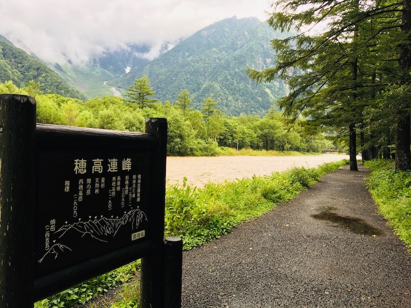
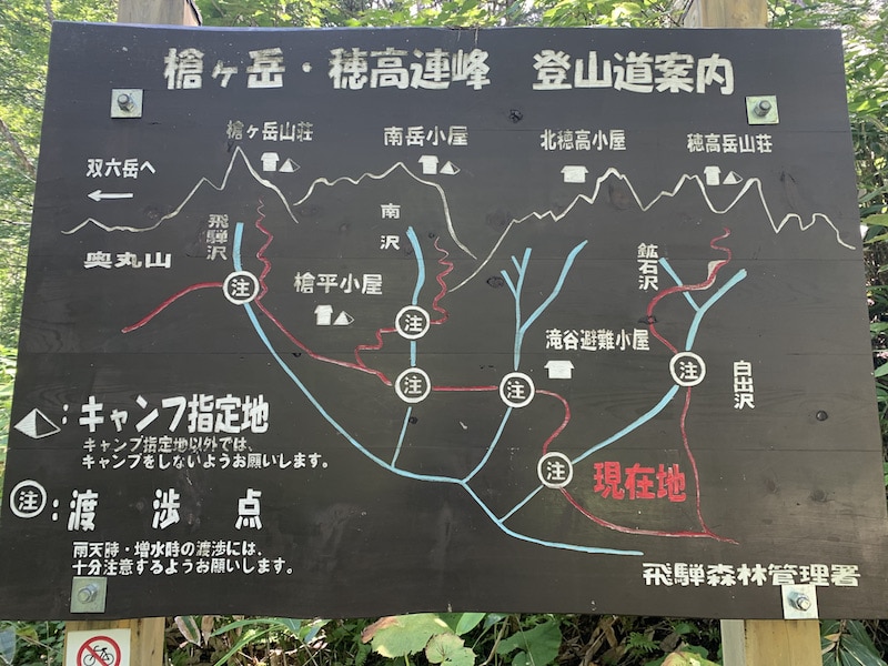
“Mt.Gendarme” is a 3,163-meter high rocky ridge located on an advanced route in the Northern Alps in Japan. The Gendarme traverse, where fatal accidents are not uncommon, is a coveted location for many climbers.
We had always been filled with a passion to one day go there ourselves! Finally, the opportunity to fulfill that dream came, and we were able to enjoy it to the fullest. This is a travelogue of our journey through the Northern Alps, including the Gendarme traverse, which we did before the spread of COVID-19.
目次
- On a certain day in August
- Day 1
- Day 2
- 04:00 Departure from Nishihotaka Mountain Hut towards Gendarme.
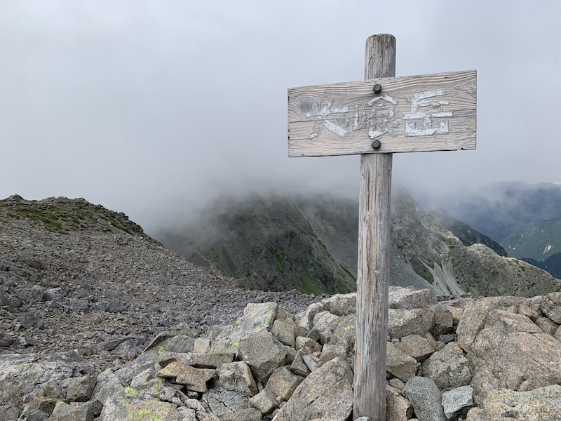
- 06:15 Arrival at Mt. Nishihotaka
- 07:00 Departure from Mt. Nishihotaka
- 08:30 Tengu rock
- 08:35 We finally reached Tengu no kashira safely!
- 10:30 Conquering the Gendarme!
- “Faaaaaaaaaall !!!”
- “Bang! Bang! Baaaang!”
- 12:30 Uma-nose
- 12:40 Arrival at Mt.Oku-hotaka
- 13:30 Hotaka Mountain Hut
- Day 3
- DAY4
On a certain day in August
During the peak climbing season in the Alps, we went on a long-awaited Gendarme expedition.
We traveled all the way from Kyushu. Since we were going all the way to the Northern Alps, we planned to traverse from Mt.Nishihotakadake to Mt.Yarigatake, not just Gendarme.
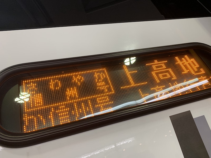
We started from Kamikochi, not from Shinhotaka, and entered properly from Kamikochi, not by using a ropeway.
Day 1
The overnight bus arrived at Kamikochi! We were ready to go, but unfortunately, it was stormy weather!
We waited for several hours for the weather to clear up. Although the weather forecast said it would clear up soon… we prayed for good weather.
After about an hour, the rain stopped, and the weather finally improved enough for us to start walking!
This was the moment we had been waiting for! We were aiming to leave this damp world behind and reach the world of the sky!
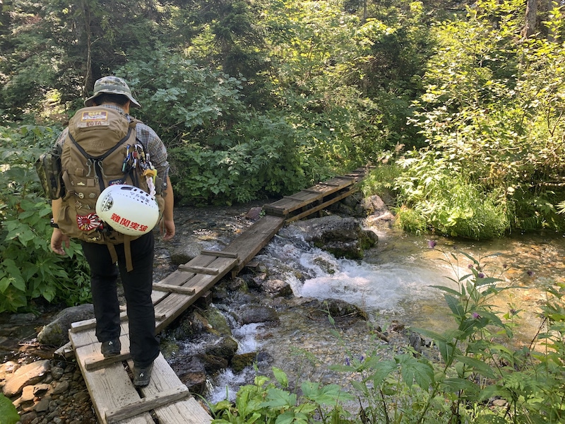
08:30 Departure from Kamikochi bus terminal and start climbing!
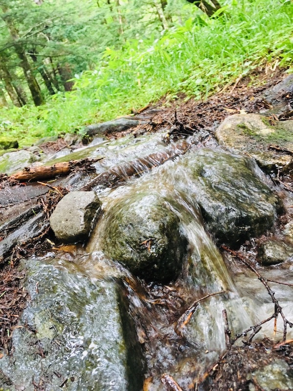
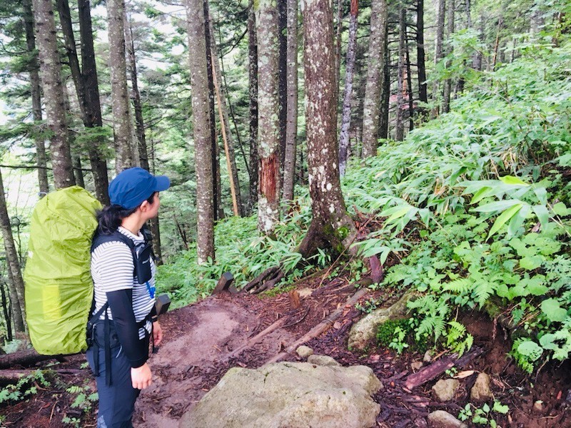
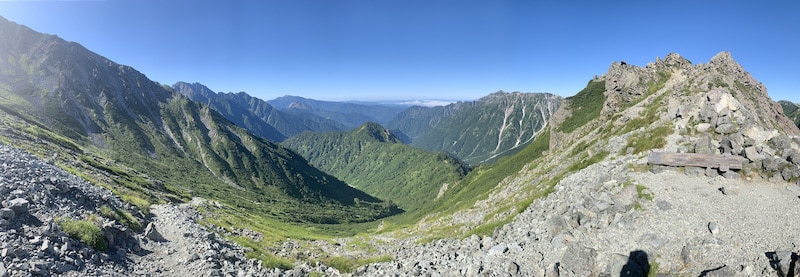
We climbed towards Nishihotakadake Mountain Hut through a path that had turned into a stream and a damp forest.
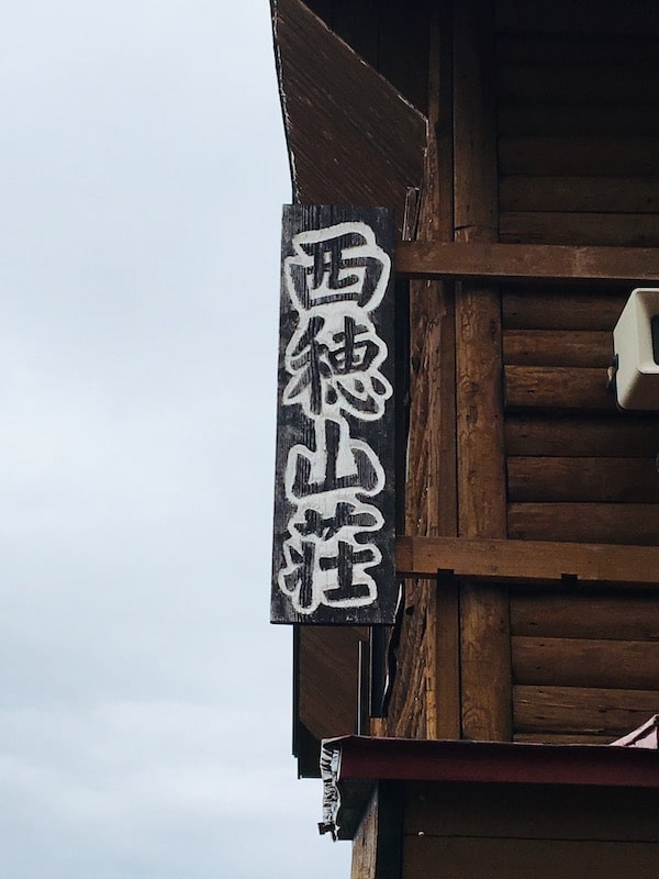
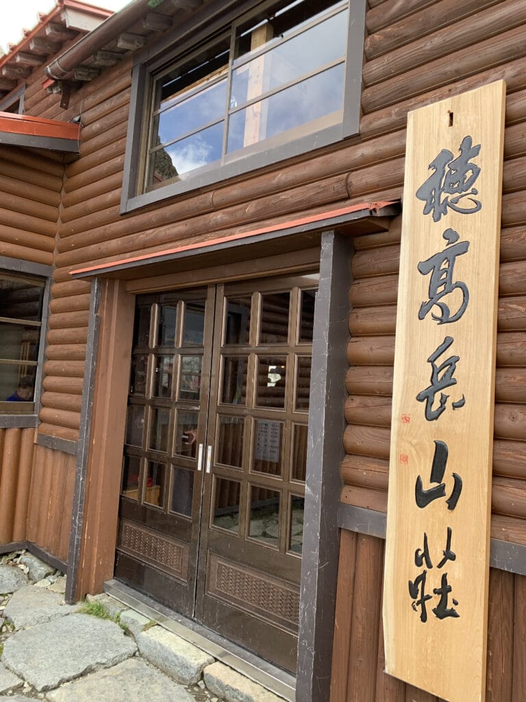
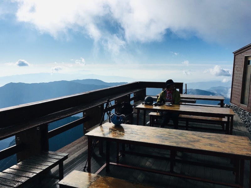
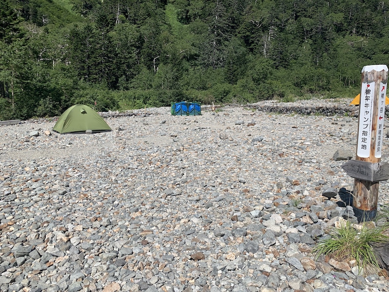
11:20 Nishihotaka Mountain Hut
We encountered some rain along the way, but we safely arrived at Nishihotaka Mountain Hut with some spare time.
Since the weather was not good on the first day, we walked to Maruyama, but the view was not breathtaking, and it was just a walk.
In the mountain hut, we kept looking at the climbing map multiple times and were excited and nervous for the climb from tomorrow.
It was our first attempt at Gendarme, so we decided to stay at mountain huts for safety reasons.
Nishihotaka Mountain Hut had a warm and cozy atmosphere with lantern lighting, which made us feel comfortable.
Day 2
04:00 Departure from Nishihotaka Mountain Hut towards Gendarme.
Finally, it’s showtime to traverse the dangerous route! We will leave Nishihotaka Mountain Hut at 4:00 in the morning to aim for Gendarme!
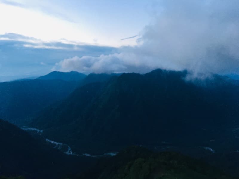
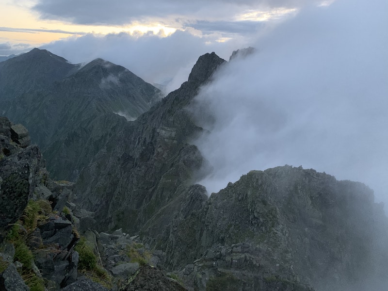
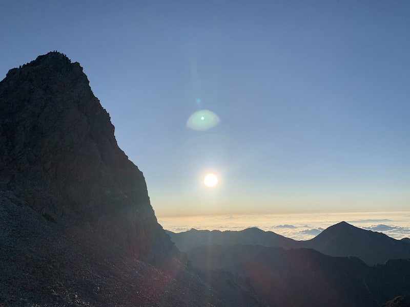
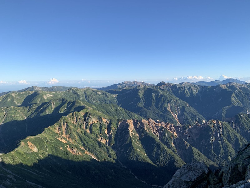
We depart in the pitch-black pre-dawn, and as it starts to get light, we can see the clouds clearing away.
Wow! It’s like a scene from a movie. The rugged mountain range with its rocky outcrops emerging from the flowing clouds is truly breathtaking!
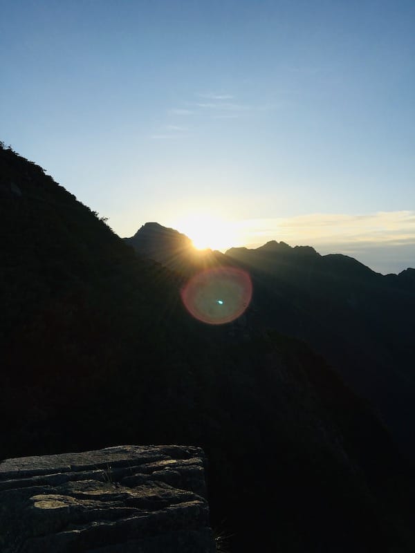
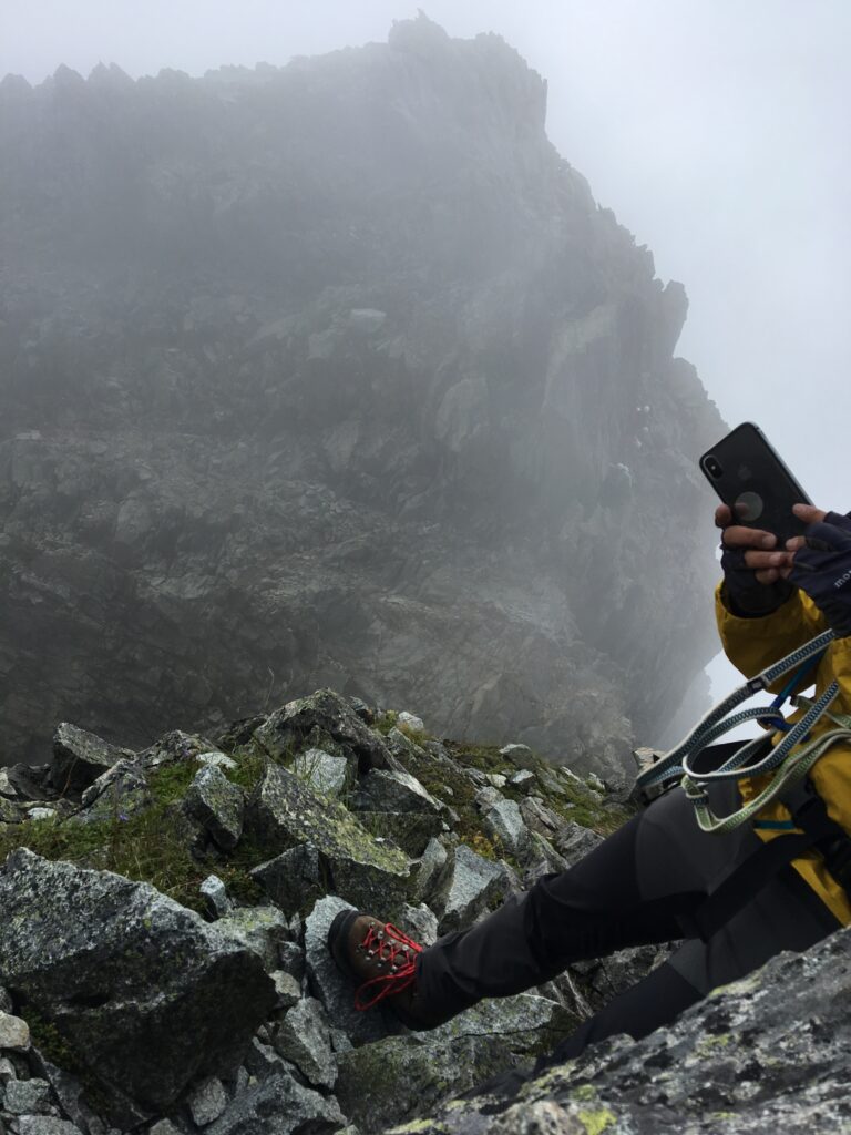
Our excitement reaches its peak with the sunrise! I was so excited that I didn’t even notice my fingers getting in the way while filming! (lol)
The orange morning sun illuminates the sheer mountain range, a world completely different from yesterday’s thunderstorm!
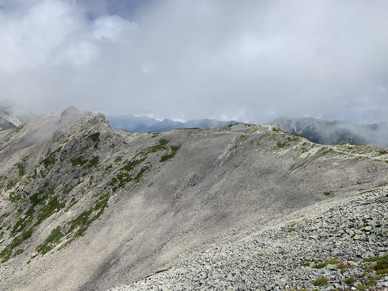
With such a stunning view and rock faces around us, it’s impossible not to be exhilarated. We were so absorbed in climbing that we reached the summit of Mt.Nishihotaka in no time.
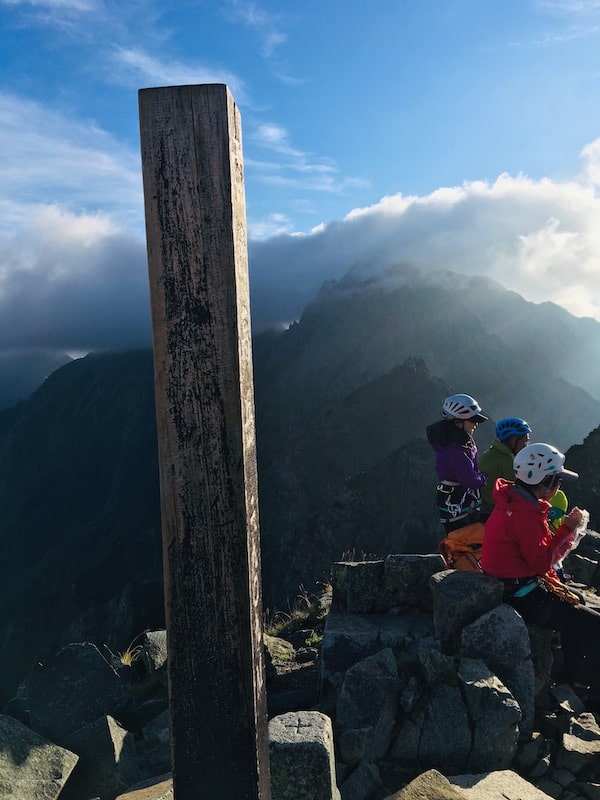
06:15 Arrival at Mt. Nishihotaka
There were about 10 people at the summit of Mt.Nishihotaka, all of whom had set out from Nishihotaka Mountain Hut.
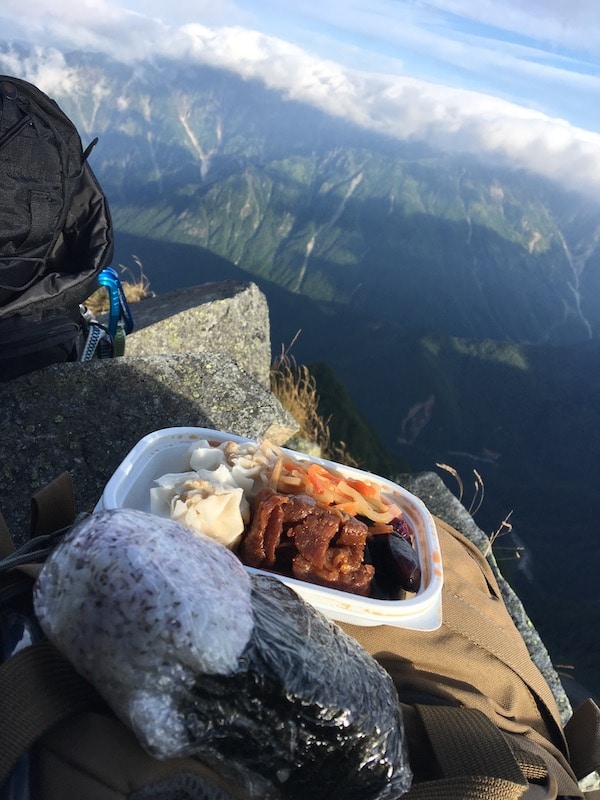
There’s only one thing to do while enjoying the stunning view! We’ll have breakfast made by Nishihotaka Mountain Hut.
If you drop your rice ball, you’re dead! The breakfast eaten on the cliffs and precipices will satisfy even the hunger for thrills.
While we were leisurely having breakfast, everyone else had already headed towards Gendarme.
We left some breakfast behind and prepared to follow suit.
07:00 Departure from Mt. Nishihotaka
A man in his fifties approached us with sparkling eyes and asked, “Are you all heading to Gendarme next?” He waved at us with a heroic expression and said, “I’d like to challenge it someday too!” before seeing us off.
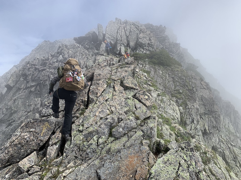
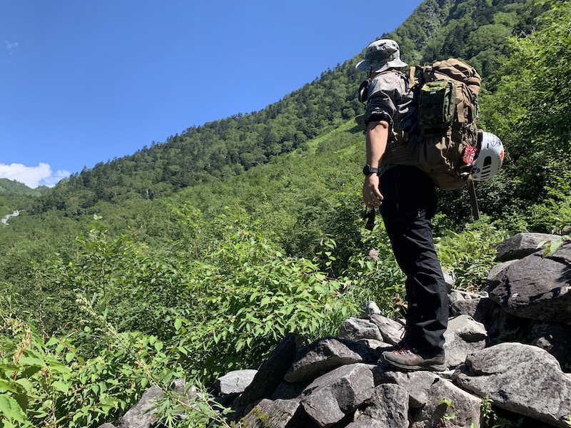
From here on, we walked through the alpine scrub on our way to Gendarme.
Looking back at the summit of Mt. Nishihotaka, we saw the man from earlier waving at us.
If he were a beginner climber, he would have been waving his hand with an envious and passionate look at those who were walking beyond this point!
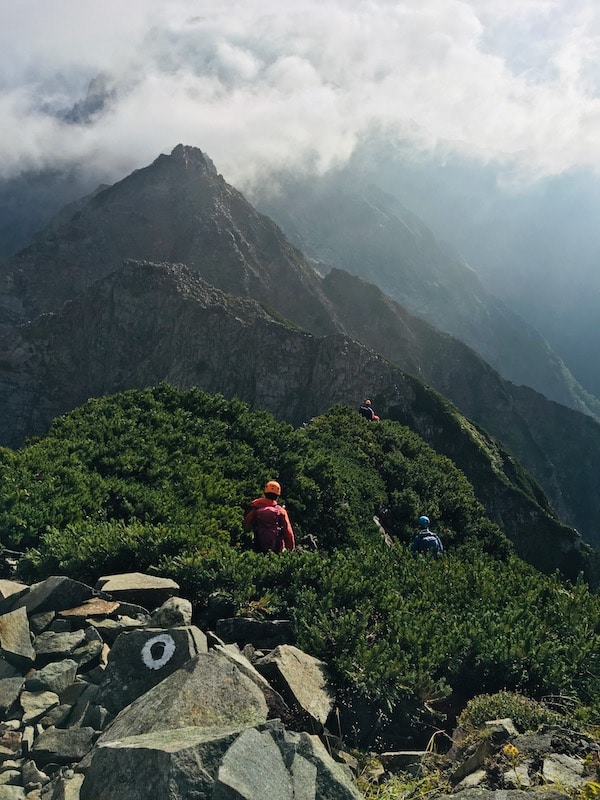
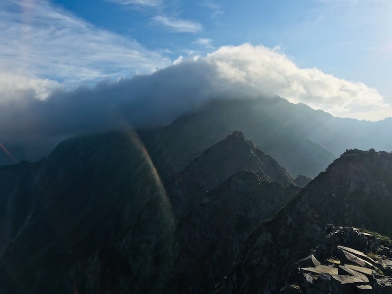
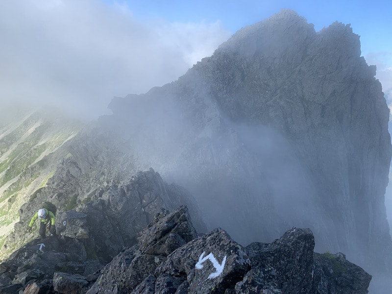
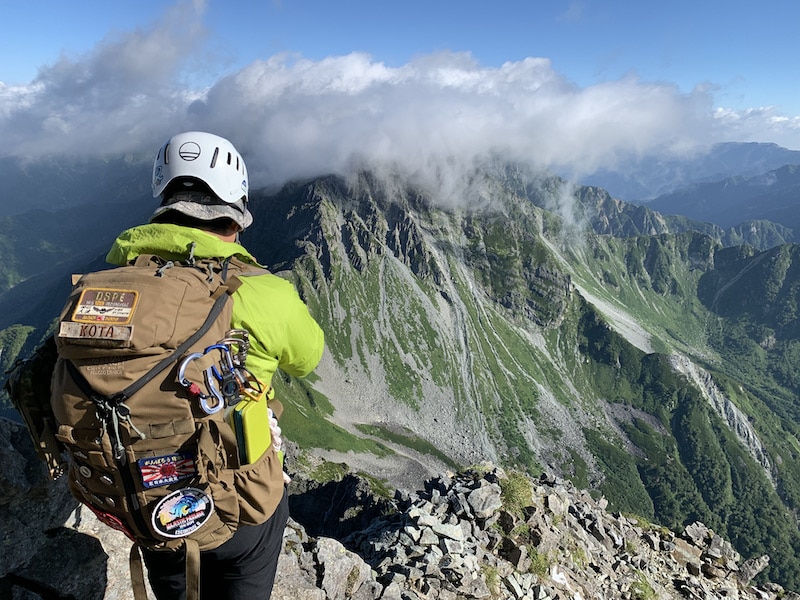
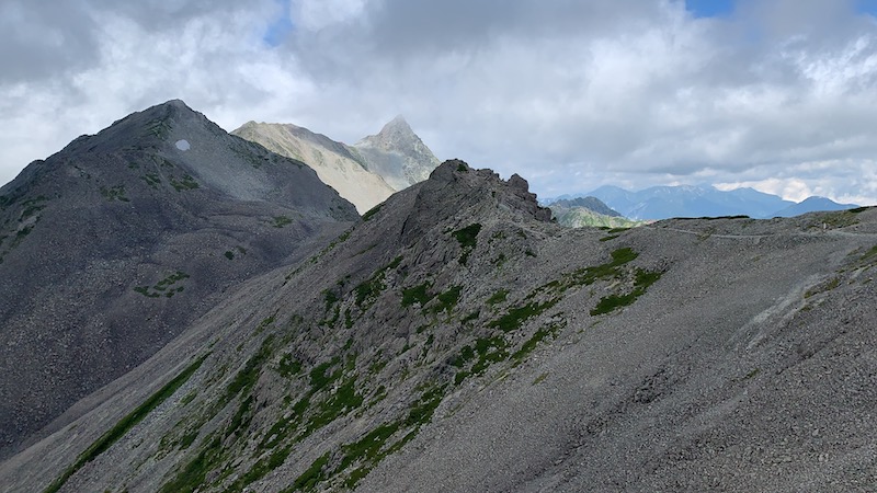
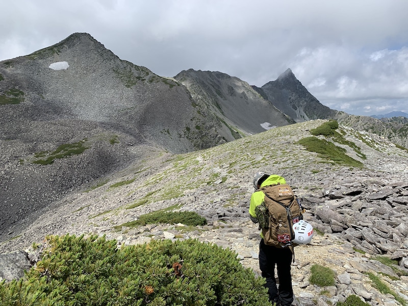
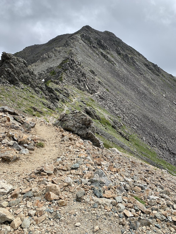
Despite feeling the heat of his passionate gaze, we faced a challenging rocky terrain that emerged from the flowing clouds ahead of us.
It was truly an overwhelming pressure, and we were reminded of the words “Trial and Aspiration” at the starting point of Mt. Hayatsuki Ridge. (Mountain trail leading to Mt. Tsurugi, which is one of the three major steep ascent.)
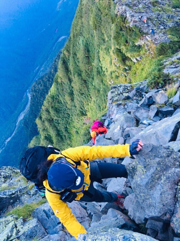
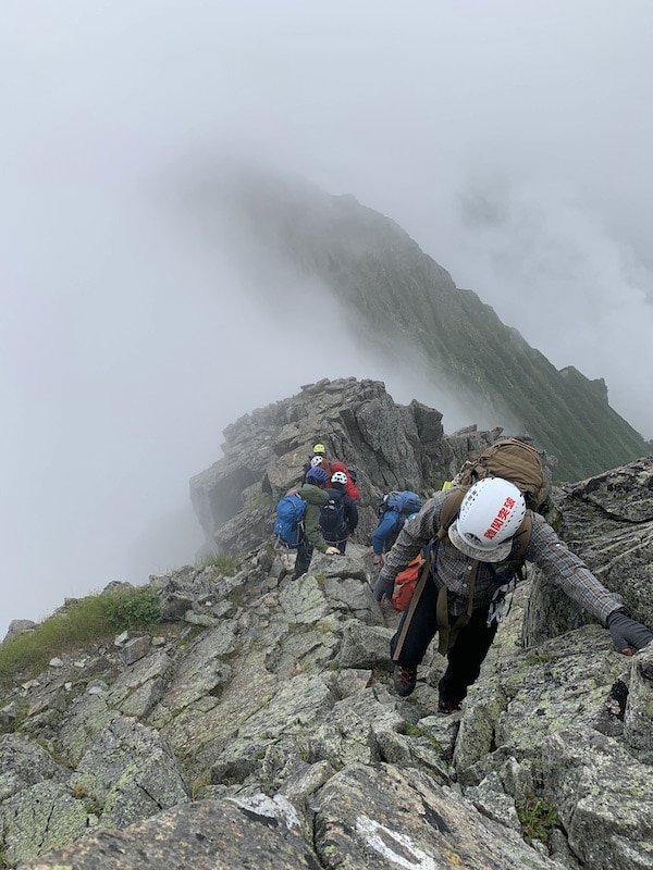
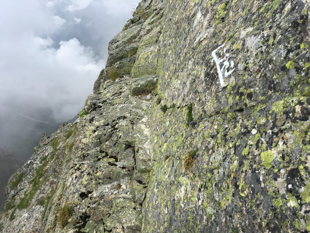
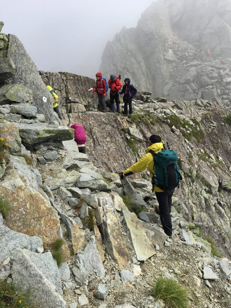
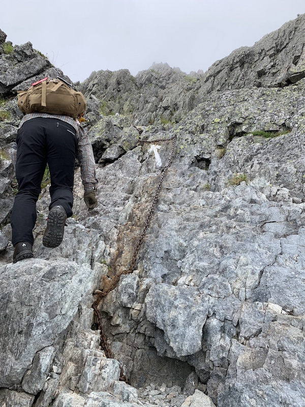
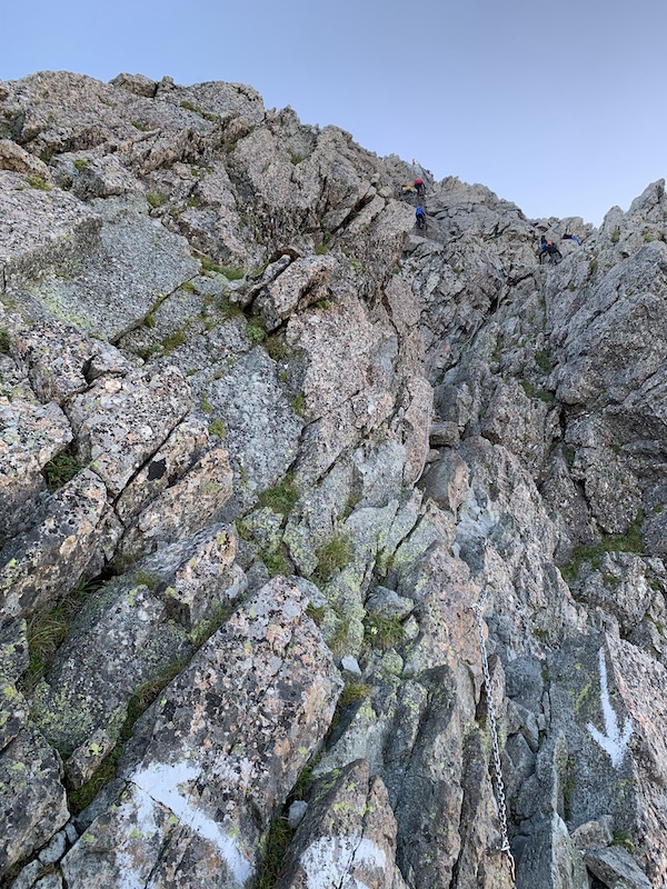
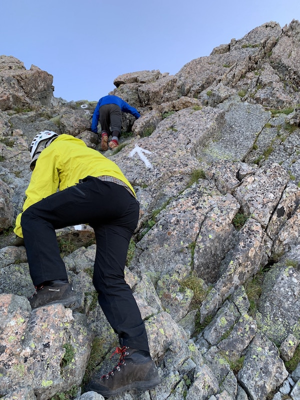
Although it was just an appetizer, we encountered many dangerous areas that required us to use both hands to clear.
We kept a distance from the parties ahead and behind us while clearing the rocky terrain in the sky.
Some members of a mountaineering club we had been following were taking a break on the top of Tengu rock.
They were the boss monkeys of the rocky mountain!
(Why are they taking a break there?)
Oh, that was just my inner voice. We passed through them without making a sound.
Was it a message that if they couldn’t pass through us, they wouldn’t let us pass through them from here on?
We slipped through the rocks and the old men.
08:30 Tengu rock
Ahead of us, there is a couple in their 50s and a couple in their 30s to 40s with a variation route guide walking. We didn’t have to worry about getting lost because there were parties in front and behind us.
Every time we come across a difficult spot, I end up shouting in surprise.
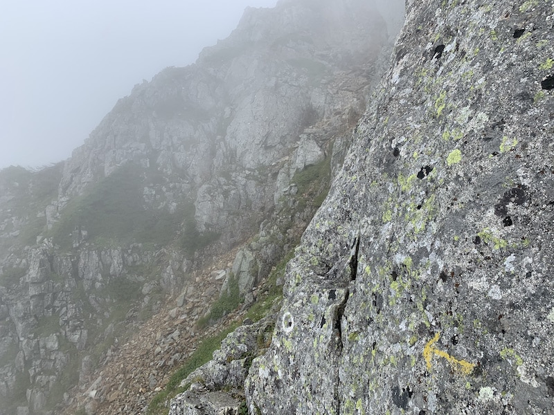
There are safe places, but there are also places where falling means instant death and places where it’s hard to tell which way to go.
The mountaineering party we passed earlier is right behind us… Even though they are using ropes, they are fast-paced veterans! They’re like a boss monkey army.
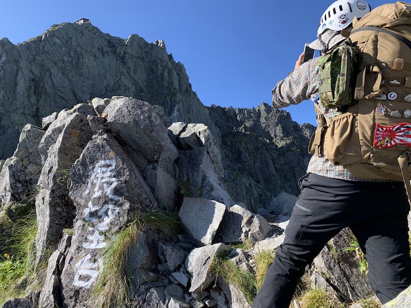
08:35 We finally reached Tengu no kashira safely!
The area is rocky, but the ground is firm and the area is spacious.
We had another party take a commemorative photo for us.
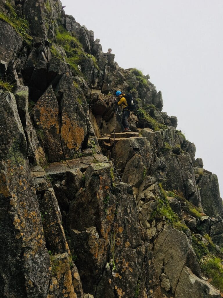
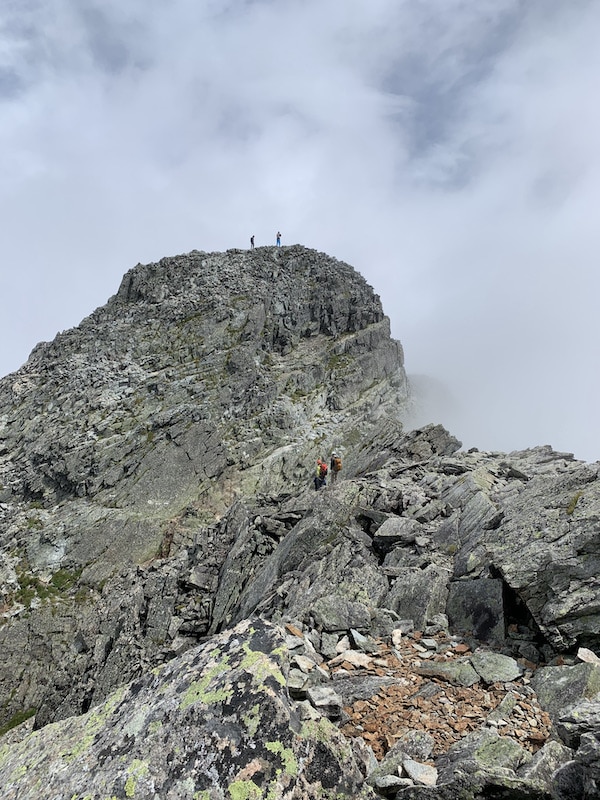
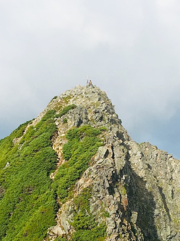
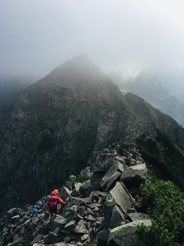
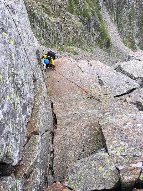
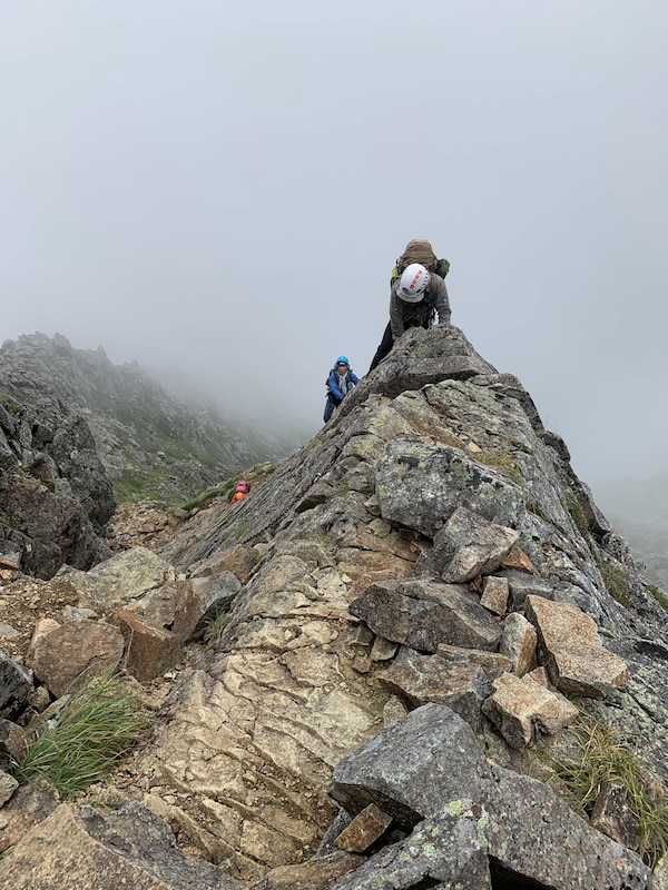
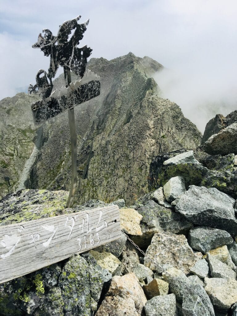
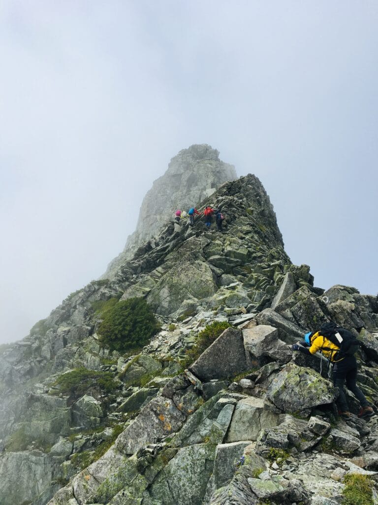
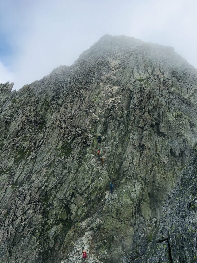
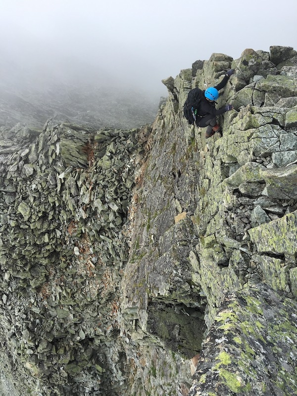
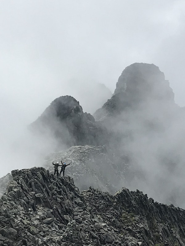
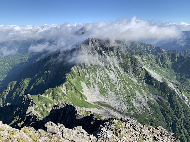
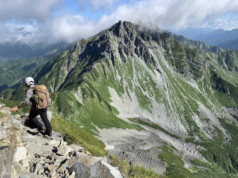
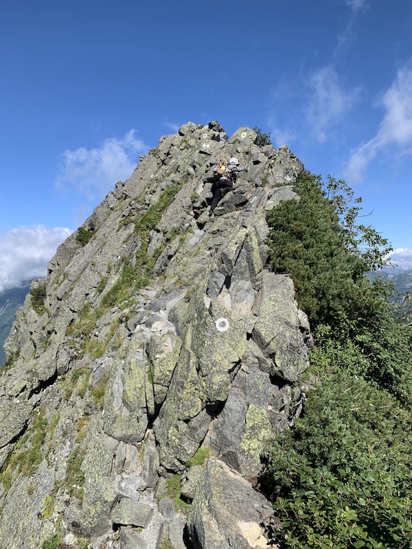
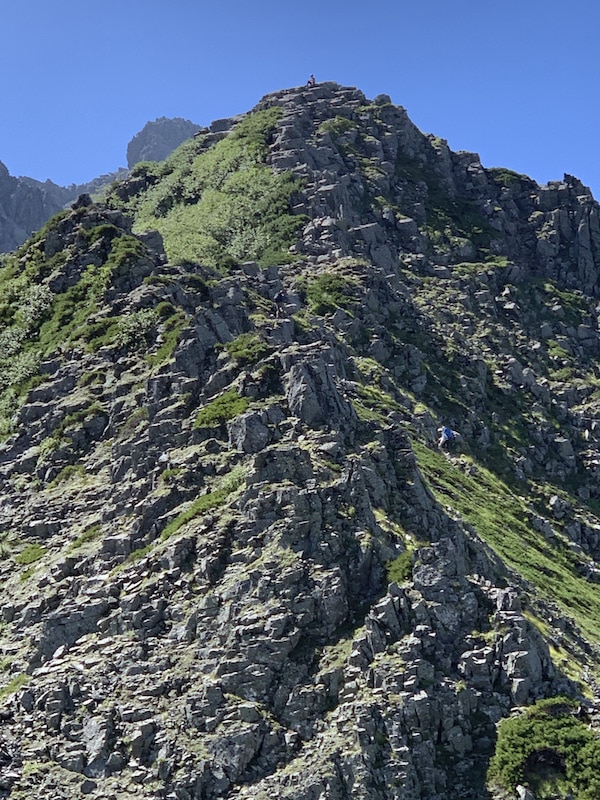
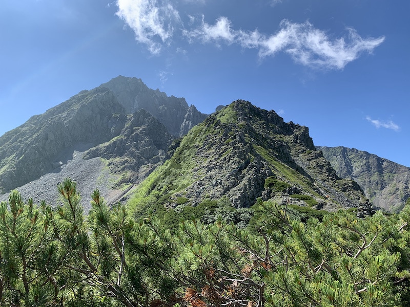
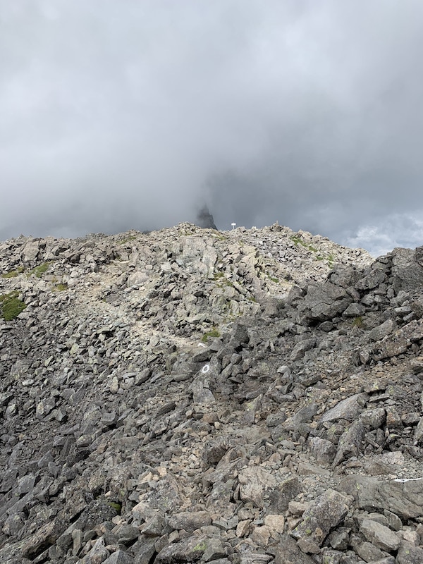
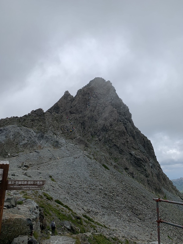
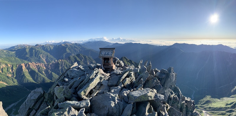
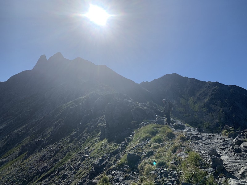
It was a series of nerve-wracking moments, clearing the rough rubble of the towering rocks, and finally, the long-awaited Gendarme appeared!
Oh, it’s stout and sturdy. This is Gendarme. Perhaps because of my years of anticipation or because I had become numb from the previous dangerous spots, I didn’t feel as much fear as I thought I would by its appearance.
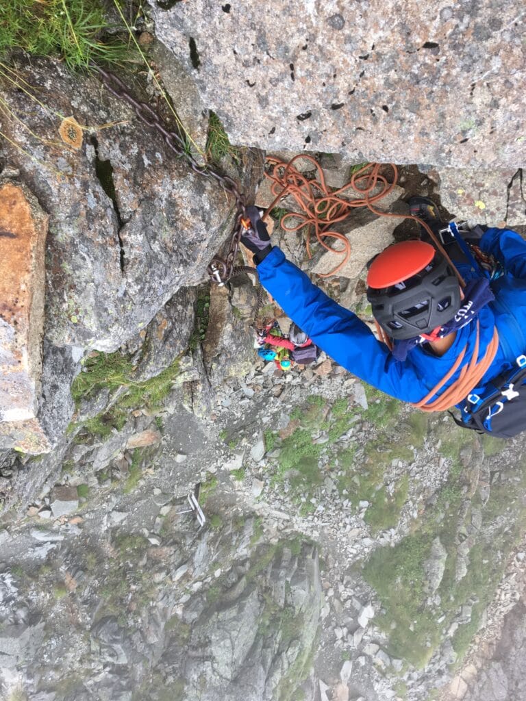
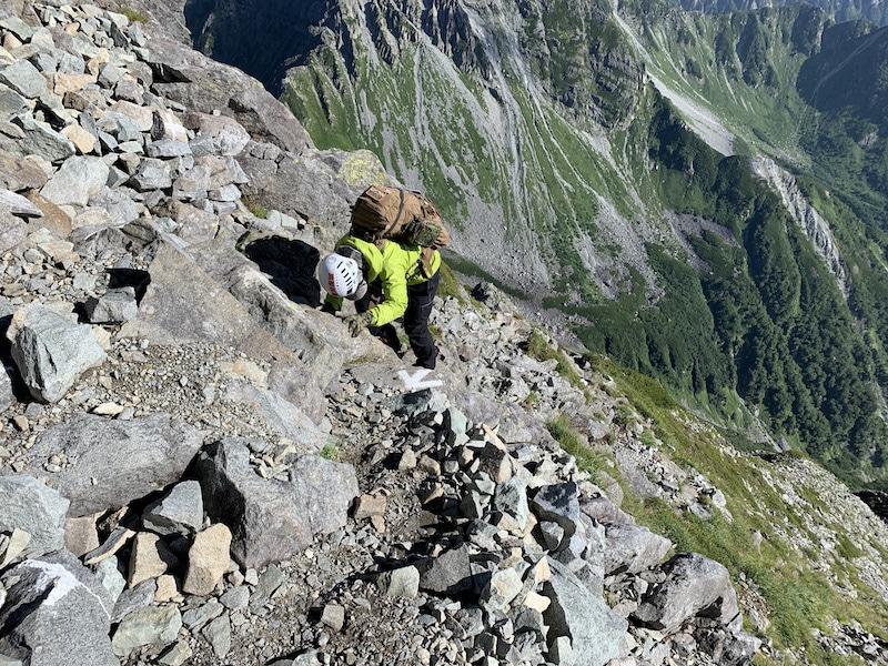
The start of Gendarme doesn’t have chains and the slope is such that if you fall, it’s instant death.
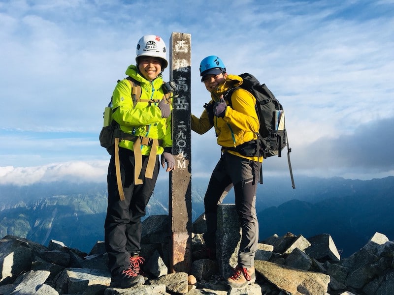
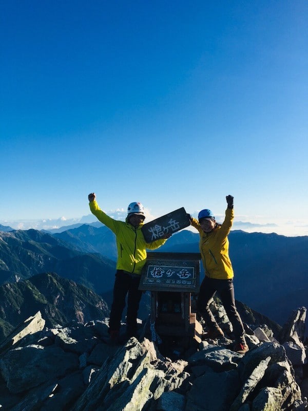
We made sure not to slip and finally reached the top of Gendarme!
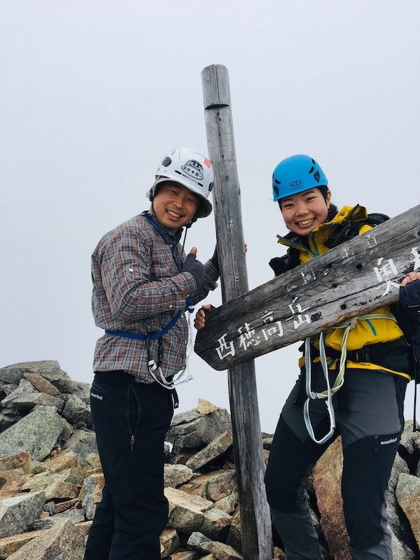
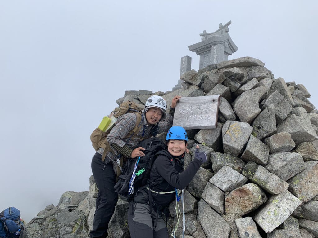
10:30 Conquering the Gendarme!
This is the Black Angel (a nickname for a signboard on the summit). It’s smaller than I thought, haha.
I ate Chicken Ramen at the summit of Gendarme. I wanted to try “eating Chicken (scaredy-cat) Ramen at Gendarme,” haha.
Anyway, after fulfilling my long-awaited gag, I left Gendarme. However, the places where we had to descend or cross were filled with thrills.
Looking at the footage, my face looks contorted, haha. It’s fun to walk through thrilling routes like this, but…
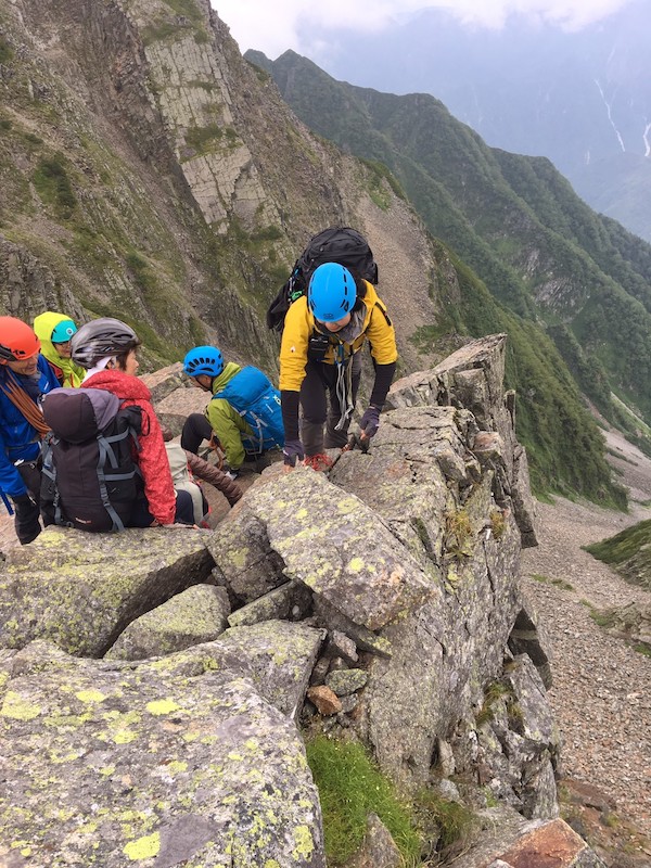
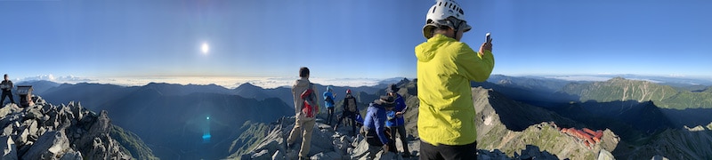
Now, right after crossing Gendarme and moving forward, a group of old ladies called “The Aunties” came from ahead, chatting and laughing noisily.
For a moment, I felt like I was at a community center gathering. The atmosphere was so lively.
No, wait, this is a dangerous route where one misstep could mean death! I quickly came to my senses and gave them a nod as we passed each other.
“Hi there!” “Great job!”
My wife and I were overwhelmed by the power of these aunties casually walking through this dangerous mountain trail.
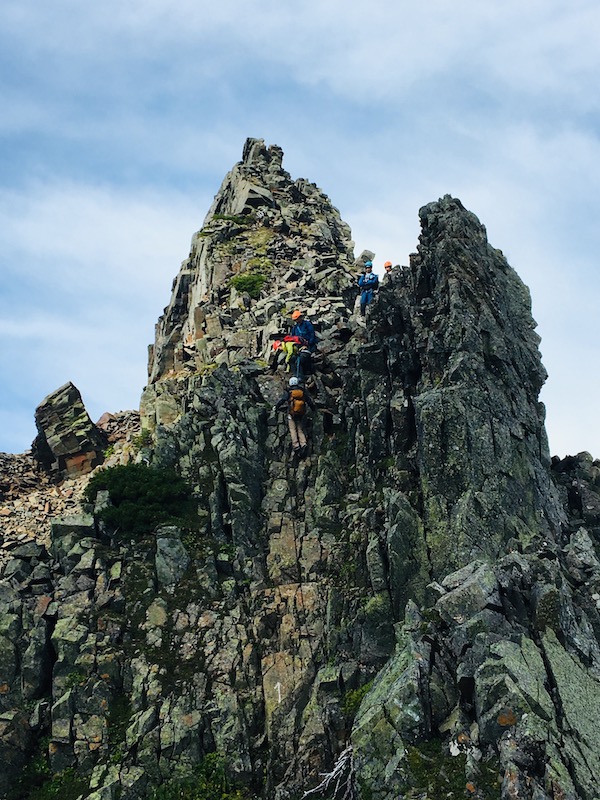
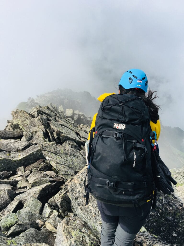
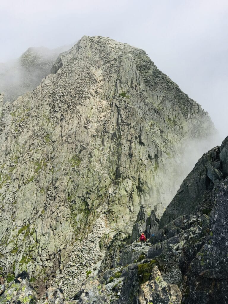
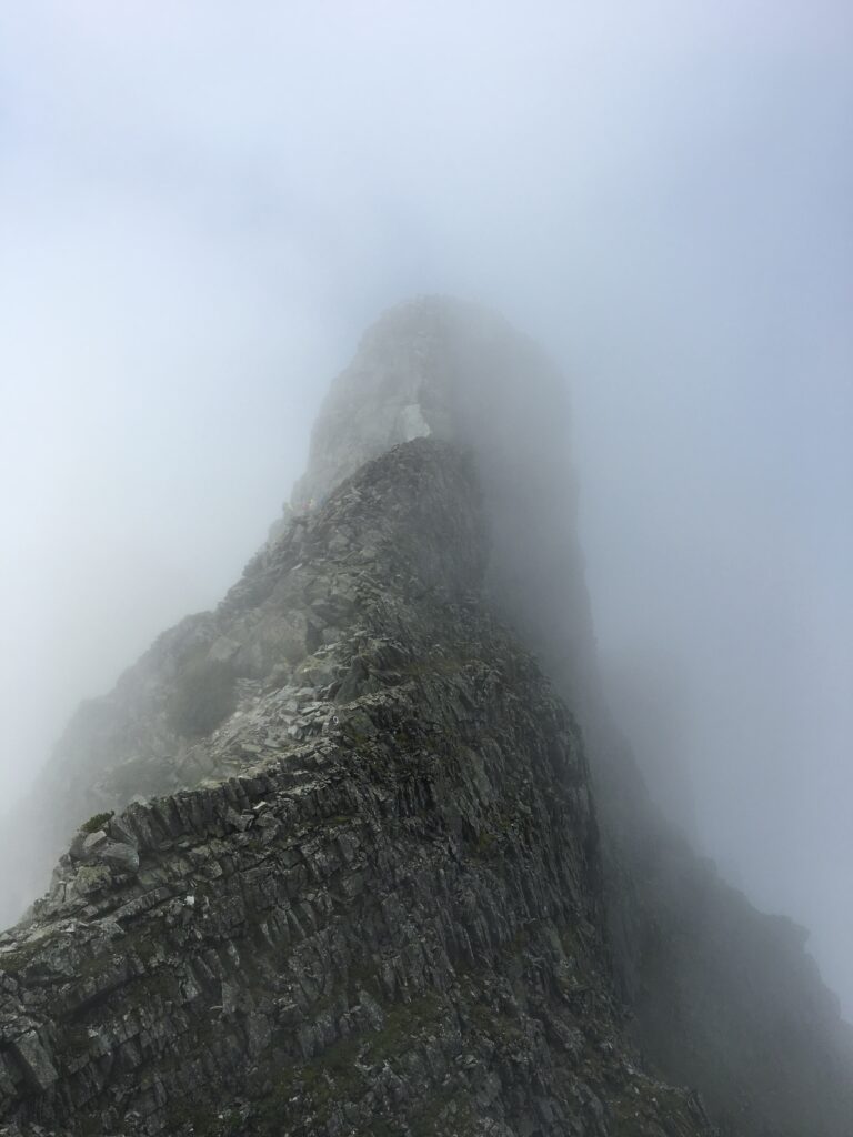
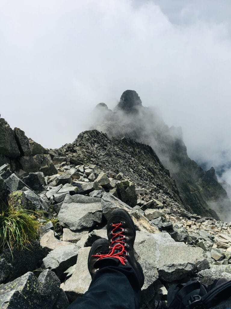
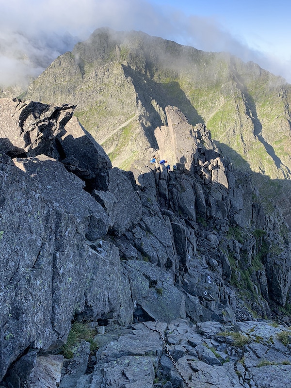
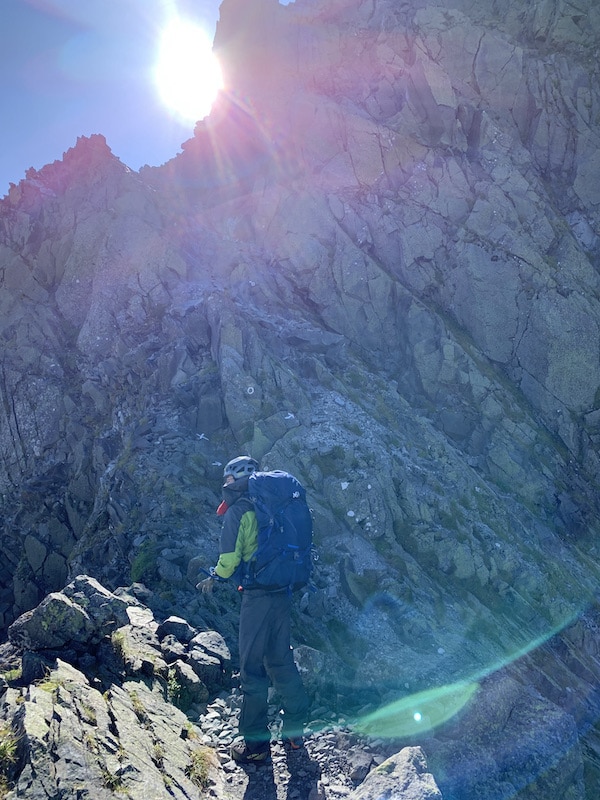
As I was busy looking at the Gendarme behind us, sometimes hidden behind the clouds, we suddenly reached a difficult point up ahead.
It was a rocky slope with a near-vertical and loose surface at an incredible height.
“We’re climbing this?!” I was scared, but I couldn’t help but gaze at it, and then I saw a guided party already starting to climb.
Behind the guided party, there are two people in their 50s, a man and a woman.
While taking a break and watching the two people in front of them climb, we decided to climb after them.
The pink woman is climbing off-route to the right.
In the moment we were discussing whether she would be okay, the blue man who was about 10 meters above the pink woman dropped a rock the size of his head.
“Faaaaaaaaaall !!!”
“Bang! Bang! Baaaang!”
The rock fell vertically on the route, making a tremendous noise as it fell into the valley.
The pink woman was desperately clinging to the gap in the rock to protect herself from the falling rocks.
If the woman had not gone off-route, it would not have been strange for her to have been hit directly.
No, if we had also continued to climb without taking a break, we could have been hit…
The two of us witnessed the terrifying scene and could only say “oh my god, oh my god” in three words.
We started to climb again after confirming that the two people in front of us had climbed to the top and disappeared from view.
We climbed up, being careful not to cause any falling rocks, and made it to the top.
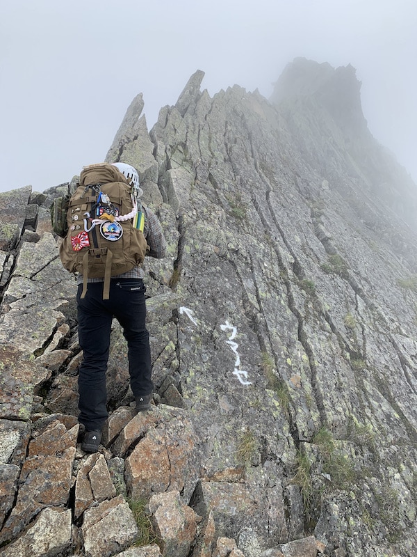
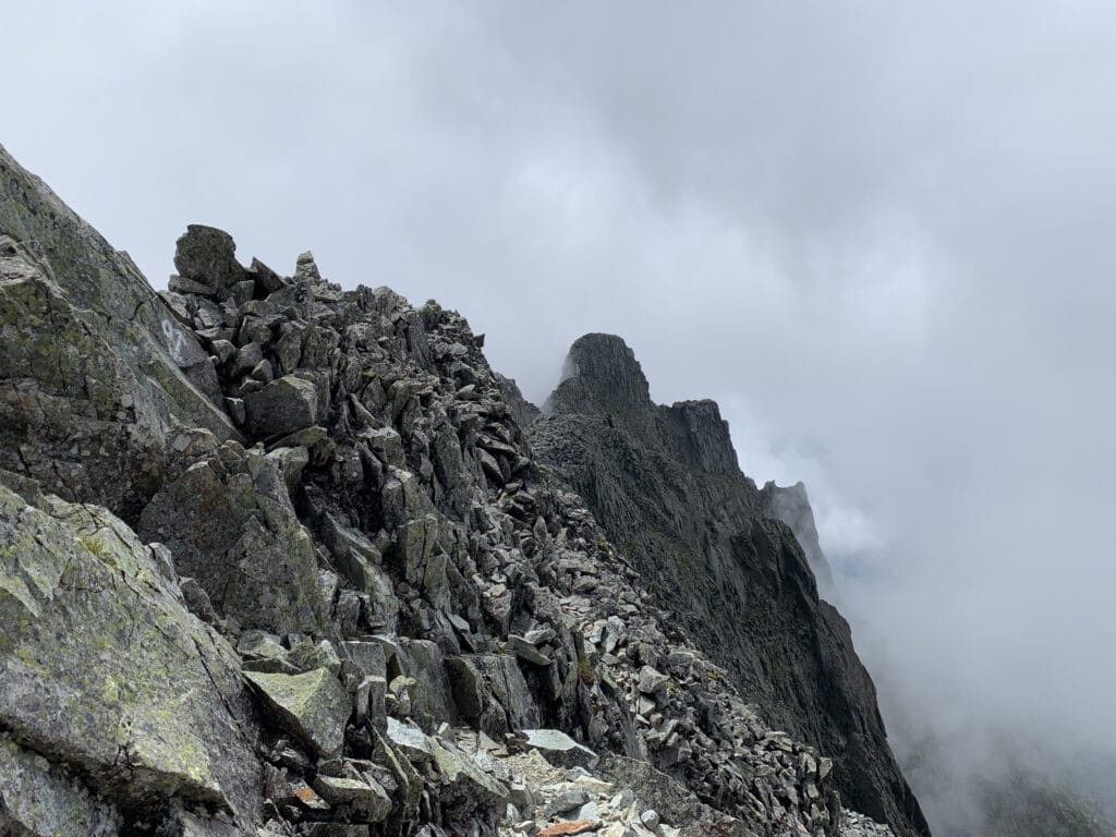
“We were in a really dangerous place!” the two of us said with a sigh of relief, and as we moved forward, we suddenly came across a rock wall in the fog that seemed like a dead end.
“Hmm? There’s a circle on the wall… ” Upon closer inspection, it said “Uma-nose, this way.”
Wait a minute, this is bad…
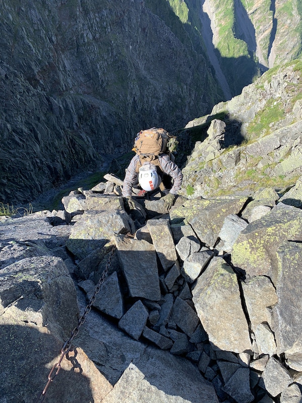
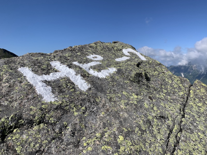
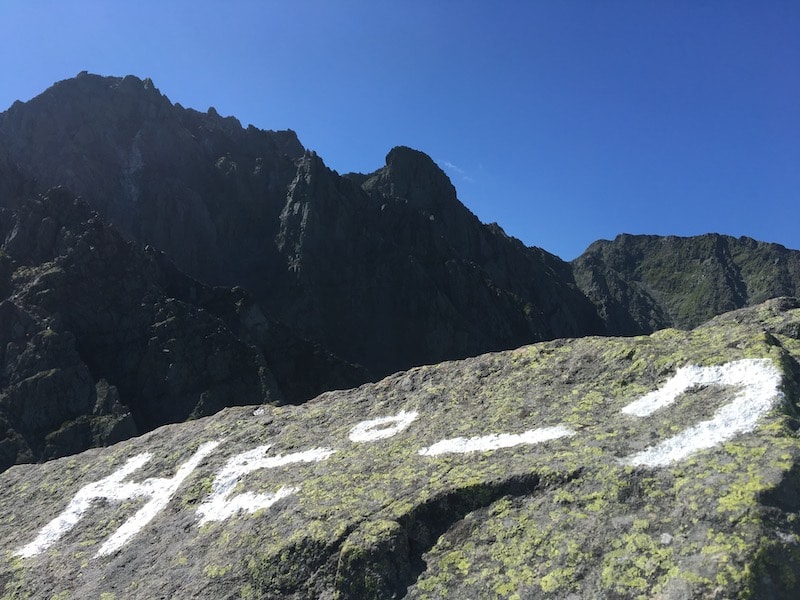
12:30 Uma-nose
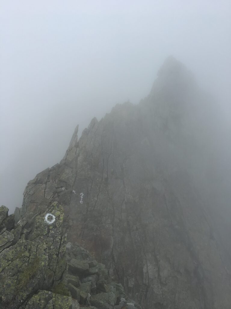
At the rocky surface, there is an arrow pointing to the letters “Uma-nose”! Is there a cliff ahead?
No, those old ladies who were here earlier climbed down here and surprised me twice. Those old ladies are amazing!
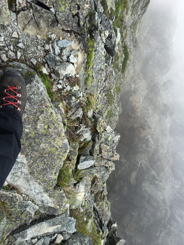
“It’s not chained… Ah, where’s a foothold…” Although I’m not afraid of heights, I felt so unstable and dizzy that I might have developed acrophobia.
Seriously, Uma-nose was scary.
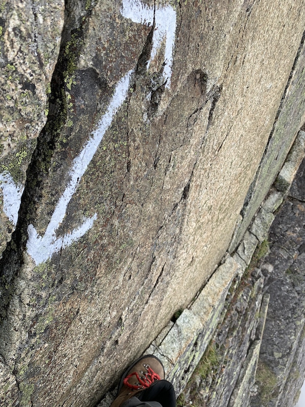
After finishing the climb, I think my face was twitching.
My wife also safely finished the climb, and look at this photo of her walking unsteadily with a wobbly feeling.
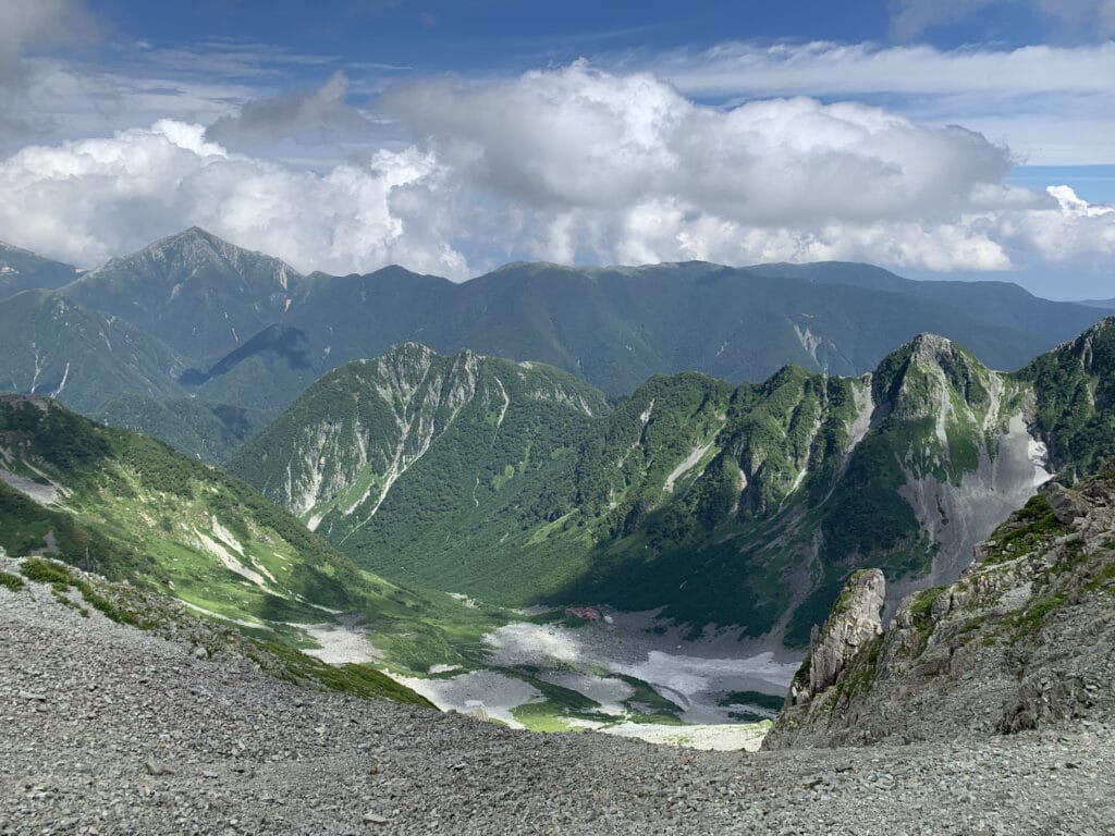
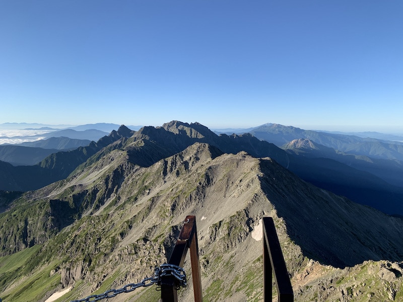
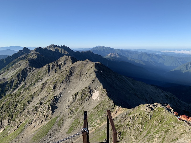
We could see Mt. Okuhotaka through a gap in the clouds when we reached the top of Uma-nose.
The variation guide’s party, who had gone ahead of us, were waving their hands and shouting “O-i!”
We also made it out safely! We waved our hands behind us as a sign of that. (A photo was taken at this moment.)
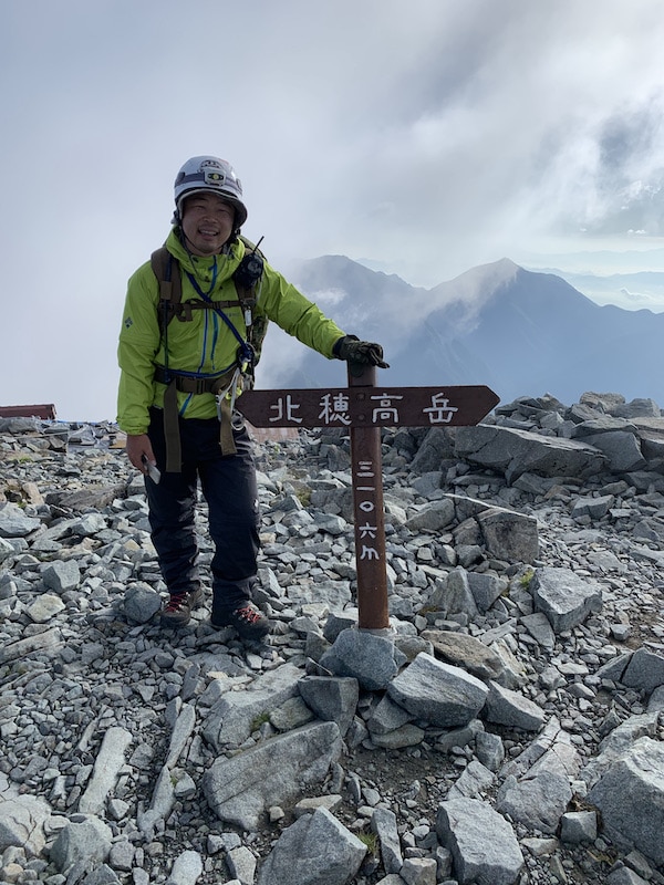
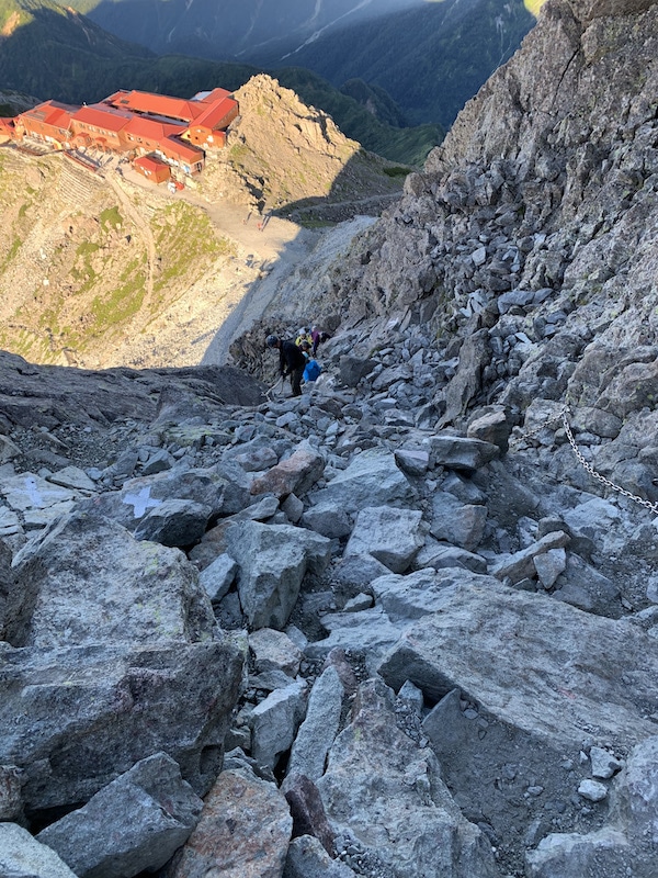
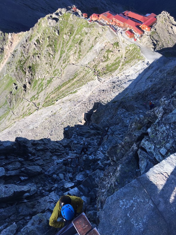
12:40 Arrival at Mt.Oku-hotaka
We arrived at the summit of Mt. Oku-hotaka feeling dizzy.
The tension that had continued from Mt.Nishi-hotaka was suddenly released.
“Oh wow, it’s so beautiful!” I heard the lively voices of a young couple who had climbed from a different route, and peace was restored instantly.
From the peaceful atmosphere, we gazed at the rugged Gendarme and watched the sunset.
“Phew…”
I don’t want to get injured just because my tension has been relieved. I remind myself not to trip on the ladder on the way to the mountain hut.
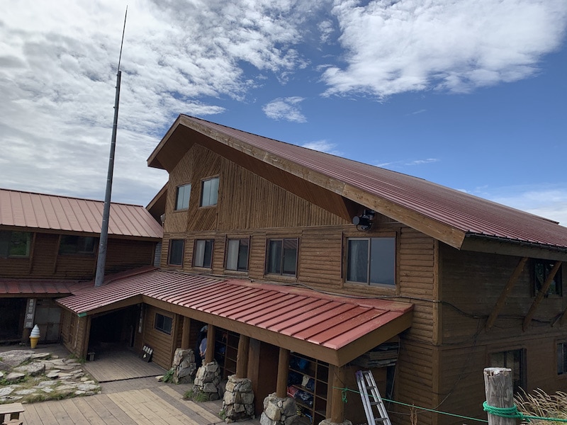
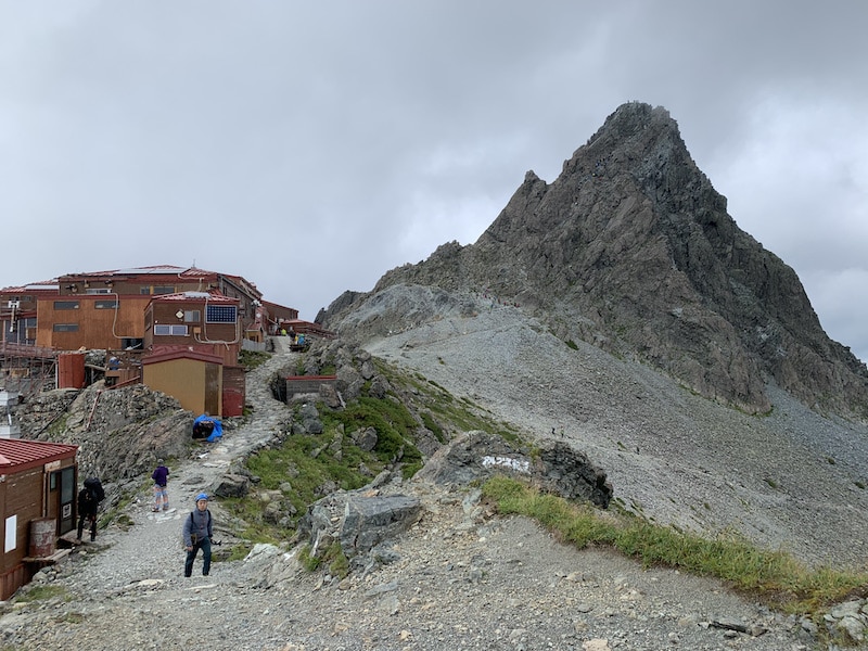
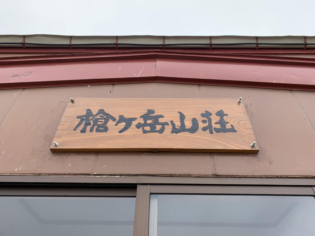
13:30 Hotaka Mountain Hut
We arrived safely at Hotaka Mountain Hut.
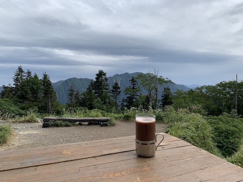
We had lunch while overlooking the stunning view of the Karasawa Valley from the mountain hut. Even though it was midsummer, the wind was cold and chilly, so I put on a down jacket.
Inside the mountain hut, the variation route guide who had been walking ahead of us said to me, “Actually, I took a photo of you guys earlier.” The photo that showed us waving our hands to convey that we had safely survived was the best one, haha.
The variation route guide said that he would be joining another customer to climb the Kita-kama-ridge(北鎌尾根) the next day, so he rested for a while and then headed towards Mt. Jonen.
He’s amazing, haha.
We slowly rested and healed our fatigue, and we are leaving at 4:00 a.m. tomorrow morning.
Day 3
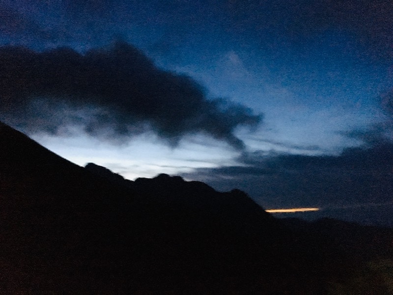
04:00 Departure from Hotaka Mountain Hut
Unfortunately, the weather is foggy. It’s pitch dark and raindrops are falling.
Probably around the time we passed the summit of Mt. Karasawa (we were lost due to the darkness and fog), it started to get brighter as we descended the rocky terrain with chains.
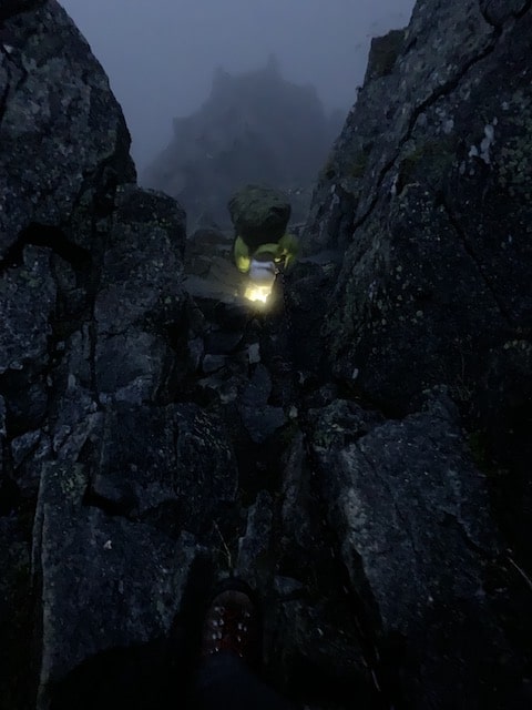
Descending the chain section in the pitch dark was very scary, so the sunrise was a big relief.
At the same time, the view was full of a sense of altitude, with the feeling of “I was descending here!?”.
Since the rocks were wet and slippery, we became more cautious.
The view of the mist clearing with the sunrise was mystical, and I kept watching it for a long time (not because my feet were frozen in fear).


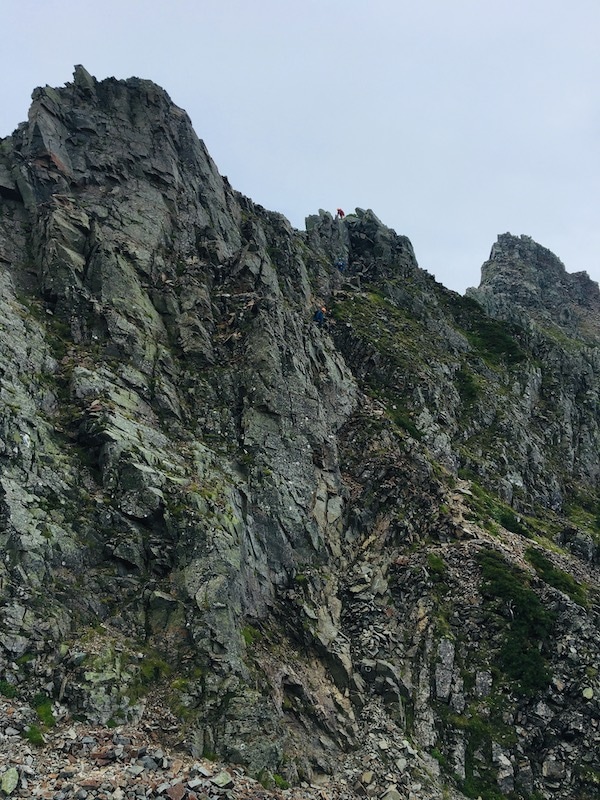
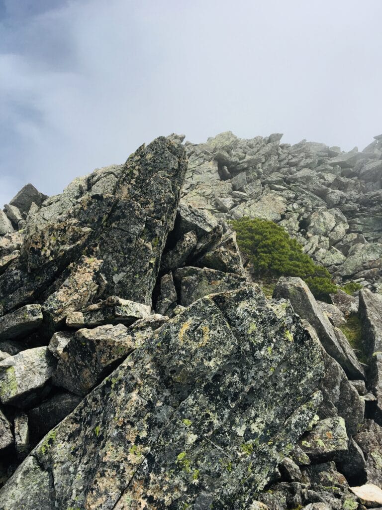
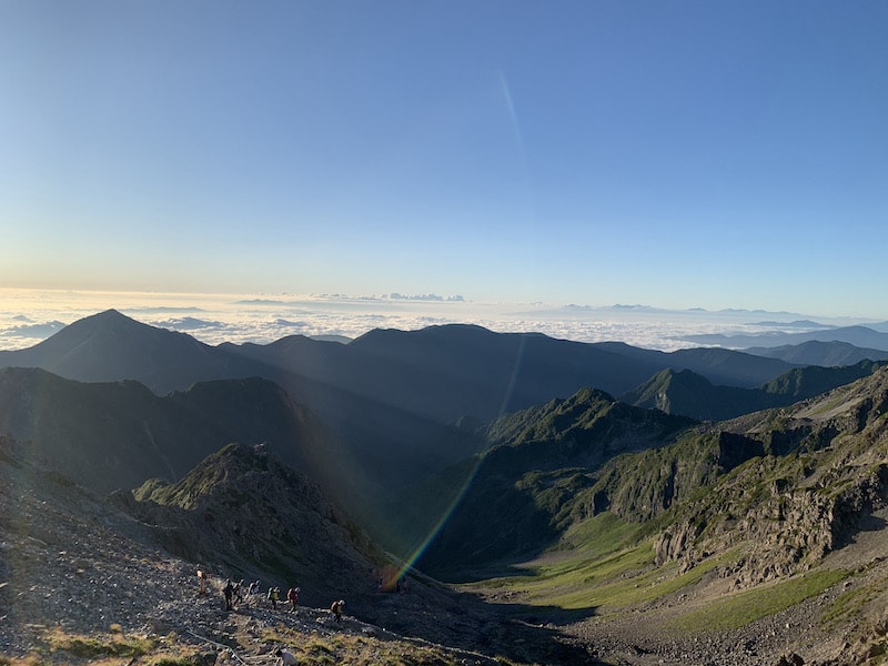
The rocky terrain from Mt.Karasawa to Mt.Kitahotaka is also a thrilling route that can be enjoyed.
By the time the sun rose, there were more and more encounters with parties going from Kitahotaka to Okuhodaka.
The scene of the strong wind and swirling clouds was also mystical. We were careful not to be swept away by the wind.
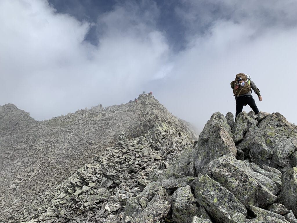
As it was a route full of enjoyable rocky areas, we arrived at the summit of Mt.Kitahotaka in no time.
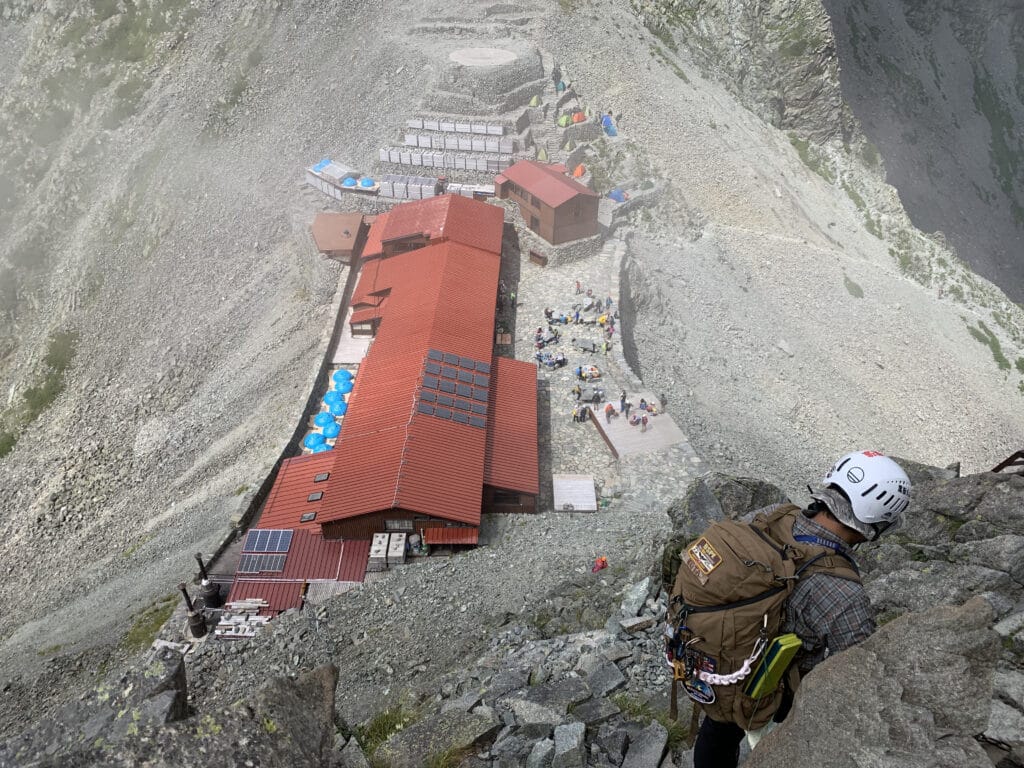
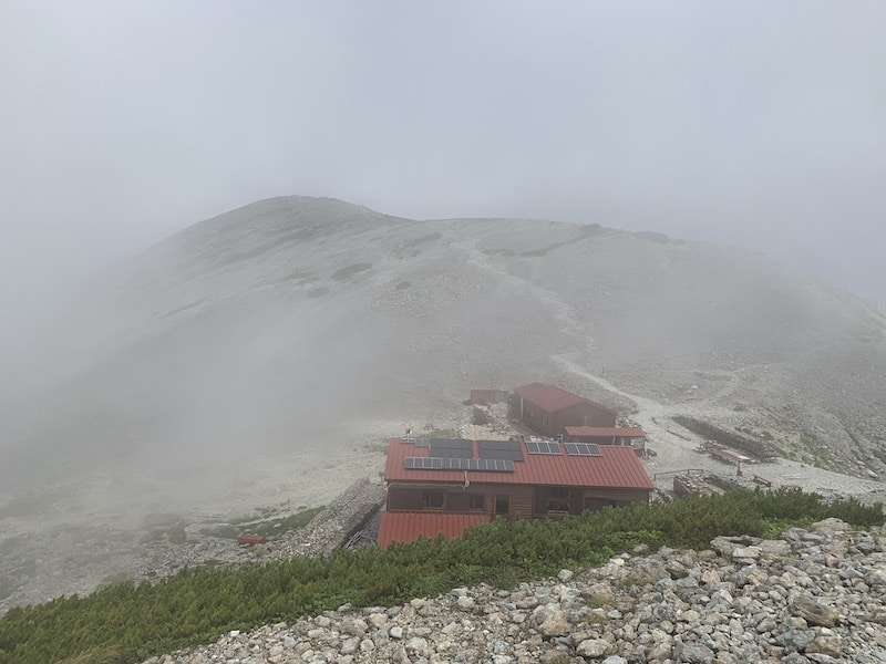
07:00 Arrival at the summit of Mt. Kitahotaka
The Kitahotaka Mountain Hut is right next to the summit! It was like a mountain hut in the sky, not a castle in the sky!
After taking a break at the Kitahotaka Mountain Hut, it was time to conquer the Dai-kiretto.
The Dai-kiretto offers an incredible view, but the thought of having to climb back up to the same elevation after descending for so long leaves you breathless. The view alone cannot express the grandeur of the experience.
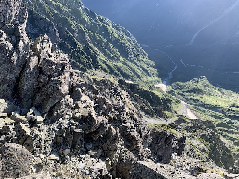
The descent route from the Kitahotaka Mountain Hut is a steep slope where rockfall is likely to occur.
Then, we descended a cliff slope that seemed to be so steep that we would not stop until we reached the forest if we slipped.
This was tough on our legs…
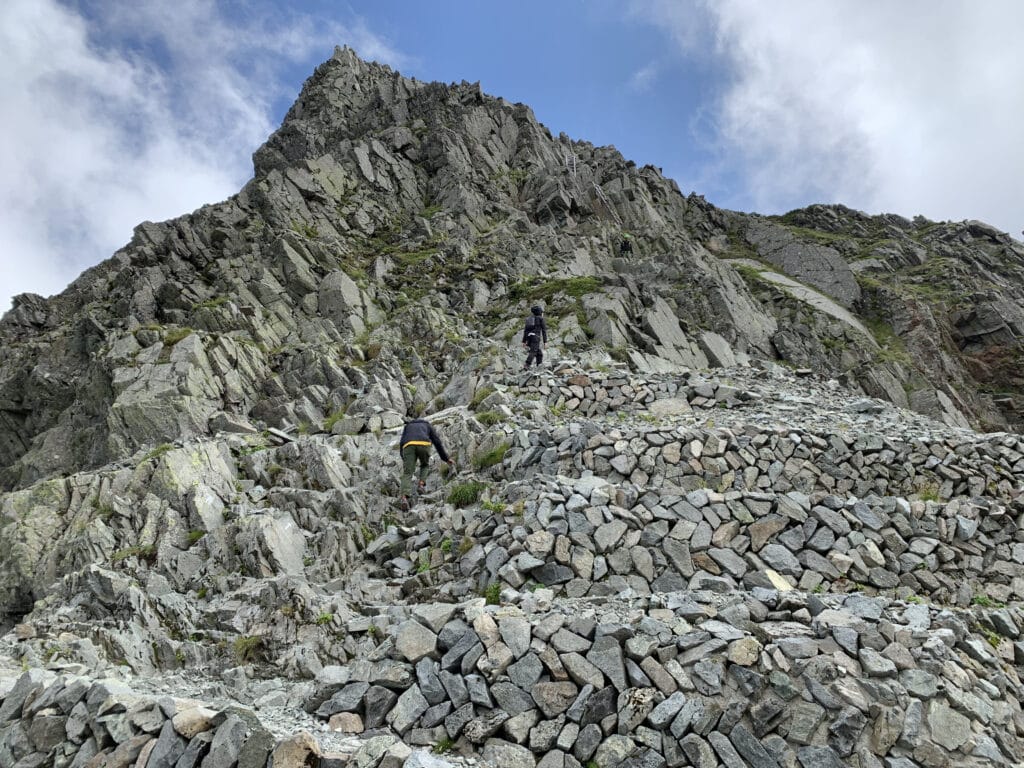
After descending a certain distance, we encountered rocky terrain.
From the observation deck, we could see the Kitahotaka Mountain Hut towering on the top of the cliff… It felt like looking up at a heavenly building from hell.
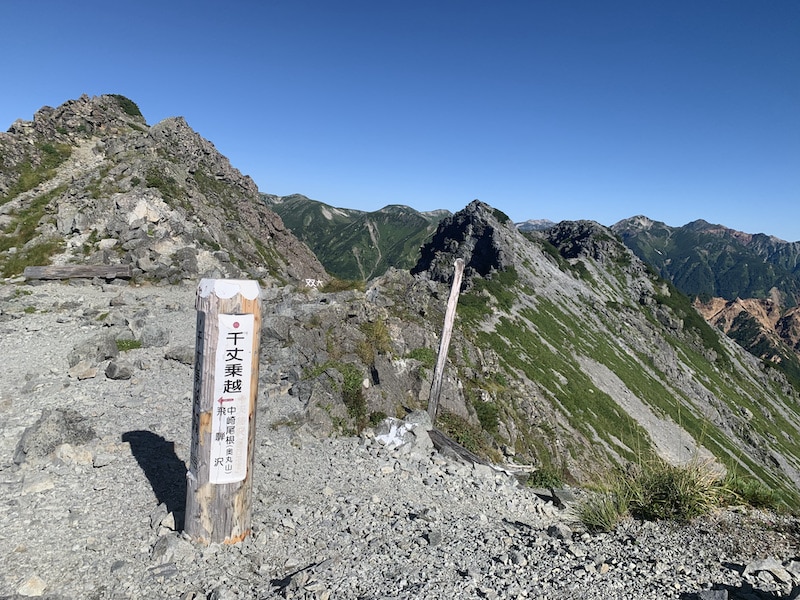
We carefully walked the narrow path where a slip to the left or right meant certain death and finally reached the col of A-sawa.
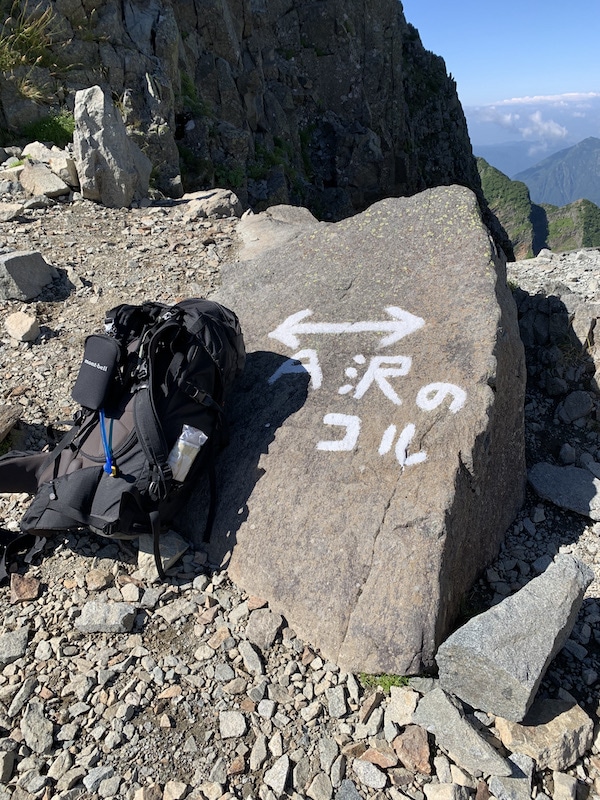
09:10 Hasegawa Peak
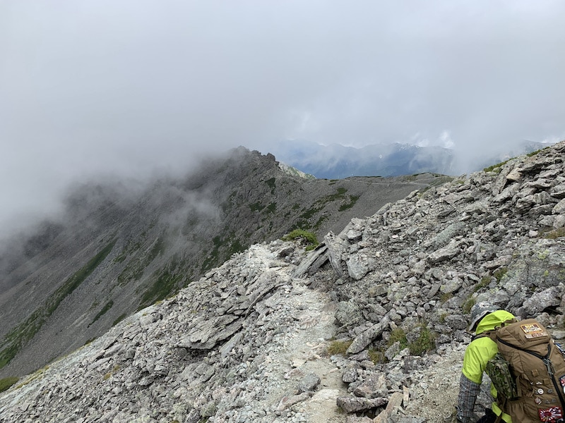
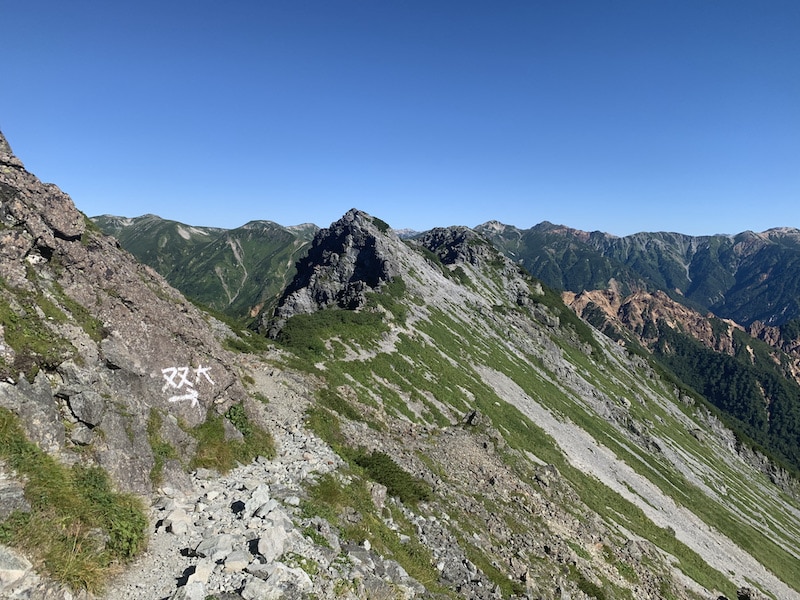
Once you reach Hasegawa Peak, there are no more dangerous spots to worry about.
You’ll walk through the deepest part of the Dai-kiretto while feeling changes in temperature.
As you approach the same elevation you descended from, the long journey starts to weigh heavily on your feet.
At the top of Hasegawa Peak, there was someone sitting there the whole time. Indeed, this scale is something you want to feel for a long time.
Now, the climb back up from Dai-kiretto is not as dangerous on the Kitahotaka side, but there are continuous steep chain sections.
No, maybe it’s because the sense of danger has been numbed due to the previous route. Looking back, there was certainly enough altitude and it was a dangerous spot. Lol.
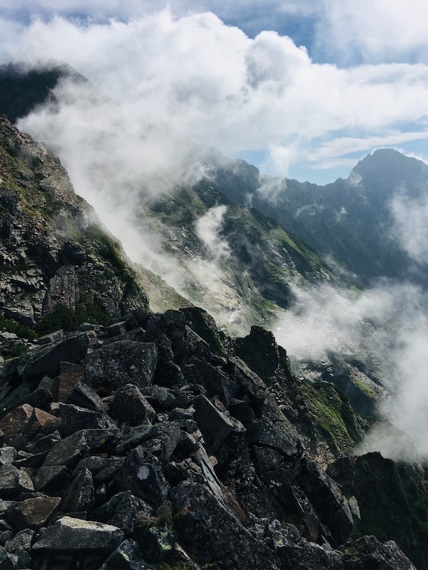
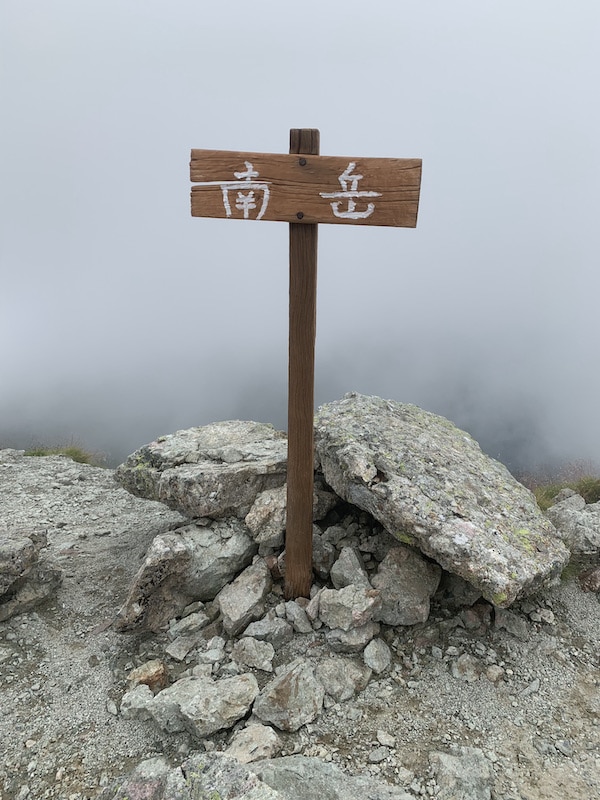
While it was visible from Kitahotaka, by the time you arrive at Minami-dake, it’s covered in fog.
The blue sky from just a moment ago is now completely enveloped in fog.
I thought that since it was so clear, the clouds over Minami-dake would clear up too, but they never did
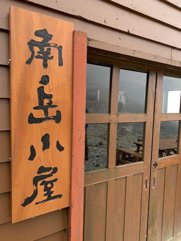
10:45 Minami-dake Hut
We’ll have lunch at Minami-dake Hut.
After taking enough rest, we depart towards Mt. Yarigatake.
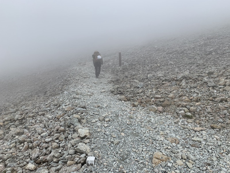
It seems like we’re walking just below the clouds.
The view occasionally clears up, revealing that only this area is covered by clouds.
We are at a height where the clouds seem to be within reach.
Mt. Yarigatake keeps teasing us by peeking in and out of the clouds.
After leaving Minami-dake hut, there were hardly any steep rocky areas, and the route was a flat ridgeline walk.
Mt. Yarigatake disappears just when we thought we saw it, and an unremarkable ridgeline stretches towards it.
If the weather had been clear, we might have enjoyed it more.
Around this area, we started feeling tired from the continuous dangerous routes and simply walking had become exhausting.
In a landscape where only white clouds are visible, we kept walking, chanting “once we cross that mountain, we’ll reach Yarigatake”.
13:10 Mt.Obami
I arrived at what was probably the final peak, Mt.Obami. The surroundings were completely foggy, and I couldn’t see Mt.Yari, which should have emerged prominently.
It had been 9 hours since we set out, and exhaustion had reached its peak.
We couldn’t climb up the steep slope of the last tent site at Yarigatake Mountain Hut. We managed to arrive by walking slowly and steadily. “Phew, I’m tired!”
The time this photo was taken is 13:45. It’s been about 10 hours since we started, and we’re exhausted!
13:45 arrival at Yarigatake Mountain Hut!
“This, this is Yarigatake…amazing,” I thought to myself as we walked through the highly impactful rocky terrain we’d been trekking through due to the foggy weather. It wasn’t so much a feeling of being impressed as it was a desire to stretch out and lie down.
The two of us quickly entered the mountain hut. As expected of Yarigatake Mountain Hut, it was spacious with a large entrance and many people lined up at reception.
We explored every corner of the large Yarigatake Mountain Hut. The lounge was crowded with a great number of people.
In a lively corner, I spent the time until dinner reading the manga “Gaku” and holding back tears. The dining hall was large, but we had to eat in shifts about three times.
Maybe because I was tired, I forgot to use my Montbell card, which would have given me a discount on drinks. It was such a shame…
DAY4
The next morning, the fog from the previous day had cleared, and we were able to see the most beautiful sunrise.
People were clinging to the summit of Mt.Yari like ants against a distant sea of clouds and a clear blue sky. All of the views were amazing.
The summit of Yarigatake was crowded with people who wanted to see the sunrise from the top.
We also wanted to reach the summit, but we tried to avoid the crowds and planned our ascent at a certain time to head to Yarigatake.
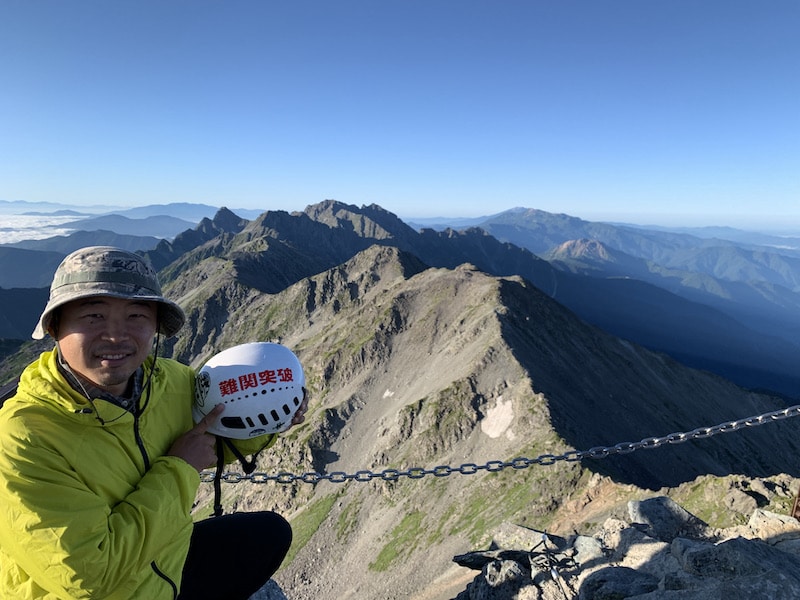
05:55 Yarigatake
We arrived at the summit of Mt.Yari.
About 10 people were taking turns taking pictures on the narrow and rugged rock summit.
In the scenery with not a single cloud in the sky, the entire path we had walked yesterday was still very beautiful.
Moved to tears,
“Haa…”
What came out was a sigh. There were no words.
The sticker on my helmet that I bought at Kurobe Dam says “Overcoming Difficulties,” and the words resonate with me no matter where I go.
Climbers continue to ascend to the summit nonstop.
Since the location is narrow, we take as many photos as we can of the scenery from the summit and descend.
07:30 Yarigatake Mountain Hut departure, beginning of descent
We are descending quickly from Yarigatake Mountain Hut to Shin-hotaka Ropeway Station.
We don’t want to part with the scenery in this weather.
Despite feeling a sense of despair, the two of us keep looking back as we descend.
08:15 Senjou-pass
When we reach Senjou-nokkoshi(Senjo pass), we will finally say goodbye to this rocky world.
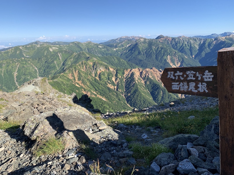
A different route from the descent route tempts us.
“Why not We’re heading Mt.Sugoroku. Ahh!”
“We have to go that way next!” we shout as we lower our altitude.
Looking back, it’s sad. We hurried down as if possessed, thinking in our heads for 2, 3, or 4 hours to turn back and return to the summit.
Sweaty hikers heading towards Mt.Yarigatake are climbing up.
On the left side is the steep mountain face we walked a few days ago.
The weather is too good, and I feel like I want to go back to that place again.
It’s a feeling that’s hard to describe.
09:45 Yaridaira Hut
As I thought, mountains are great.
While walking with a sense of loneliness, before I knew it, I arrived at the Shin-Hotaka Ropeway station.
12:35 Shin-Hotaka Onsen Station
I’m tired!
I thought I could descend in a short time, but the distance we covered in two days took longer than I expected, even with a fast pace.
Looking at the data I had been recording on YAMAP:
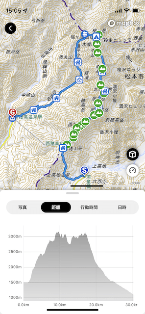
Activity time: 30 hours and 40 minutes (excluding break time) Distance: 30.2 km Elevation gain: 3,579 m Elevation loss: 3,979 m
And I burned 11,216 kcal! I think I lost about 2 kg haha.
After the long journey, we went to the Shin-Hotaka Onsen, of course!
I envy those who can easily access the Alps. Why are we living in Kyushu? We headed home while lamenting.
My long-awaited journey to climb Gendarme and traverse the Northern Alps had some tense moments, but it turned out to be a great mountain adventure.
It’s a route that makes you want to walk it again and again. Especially enjoyable was the rocky area between Nishihodaka Mountain Hut and Minamidake Mountain Hut.
Next time, I’d like to walk it on a clear day!
Everyone, please try going there!
A nearby rock climbing area from Kansai. Within one hour from Kyoto. “Sengoku Iwa”, a rock climbing area in Shiga.